Hilton, I.
Plan of the Town and Harbour of Rochelle.
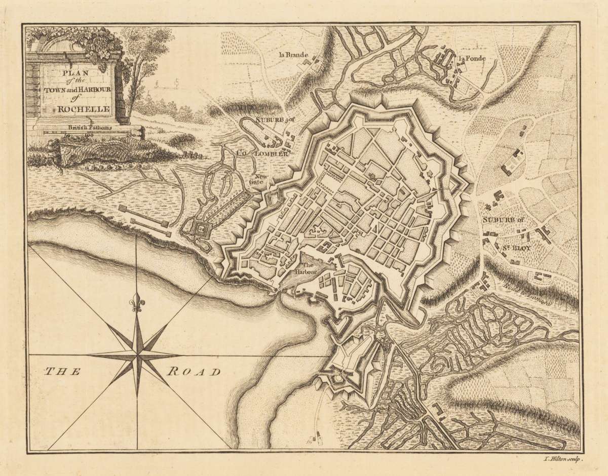
I. Hilton – Plan of the Town and Harbour of Rochelle. · Original Antique Copper Engraving, Hand Coloured · Thomas Jefferys · London 1760
Eigenschaften
- Published: London
- Published date: 1760
- Issue date: 1760
- Technique: Copper engraving /
- Type: map
- Category: La Rochelle
- Size: 185 by 240mm (7¼ by 9½ inches).
- Stock number: 24469
- Condition: In excellent condition.
Article description
Article description
Original antique copper engraving, hand coloured when published, depicting Plan of the Town and Harbour of Rochelle. Published by Thomas Jefferys, London, 1760. Sheet: 185 by 240mm (7¼ by 9½ inches).. A fine decorative example of antique cartography by I. Hilton, rich in period detail and historical significance. This harbour plan of La Rochelle was published in London, reflecting the British interest in detailed documentation of French Atlantic ports during the era of commercial and naval rivalry between Britain and France. City map of La Rochelle in France. First mentioned in 1240, it belonged in the middle age to Burgund. The artist Thomas Jefferys was an English cartographer who was the leading map supplier of his day. He engraved and printed maps for government and other official bodies and produced a wide range of commercial maps and atlases. In good condition for its age (published 1760). Colours well preserved. Some age-toning and minor imperfections consistent with a document of this antiquity. A condition report is available on request.I. Hilton – Plan of the Town and Harbour of Rochelle. · Original Antique Copper Engraving, Hand Coloured · Thomas Jefferys · London 1760
You might also be interested in the following products
 Artesia
 Original antique copper engraving, hand coloured when published, depicting Artois. Published by M. Seutter, Augsburg,...
€145.00
 Artesia. Iacobo...
 Original antique copper engraving, hand coloured when published, depicting Artois. Published in Antwerpen, 1588....
€295.00
 Elsass
 Original antique copper engraving, hand coloured when published, depicting Elsass - Alsatia. Published by Jodocus...
€240.00
 Li contorni di...
 Original antique copper engraving, hand coloured when published, depicting Paris. Published by Antonio Zatta.,...
€180.00
Recently viewed products