Eigenschaften
- Published date: 1755
- Category: France
- Type: map
- Issue date: 1755-1780
- Technique: Copper engraving / hand colored.
- Size: 153 by 192mm (6 by 7½ inches).
- Stock number: 30957
- Condition: In excellent condition. Cut close to the engraved border lines.
Article description
Article description
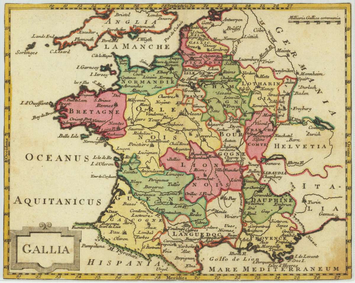
Original antique copper engraving, hand coloured when published, depicting Gallia. Published 1755-1780. Sheet: 153 by 192mm (6 by 7½ inches).. A fine decorative example of antique cartography by [Anonymous], rich in period detail and historical significance. This map was produced anonymously during the early modern period by an unknown cartographer or publisher. Anonymous maps and engravings from the sixteenth and seventeenth centuries are rare survivals that document the cartographic knowledge and printing culture of their time. An unusual small map of France not listed in various collections. According to the style of the engraving the map could be published either in Germany or England in the 2nd half of the 18th century. Many engraved names of cities and towns, rivers. A little cartouche is in the lower left side and in the upper right corner together with a small the mileage scale. In good condition for its age (published 1755-1780). Colours well preserved. Some age-toning and minor imperfections consistent with a document of this antiquity. A condition report is available on request.[Anonymous] – Gallia · Original Antique Copper Engraving, Hand Coloured
You might also be interested in the following products
 Artesia
 Original antique copper engraving, hand coloured when published, depicting Artois. Published by M. Seutter, Augsburg,...
€145.00
 Artesia. Iacobo...
 Original antique copper engraving, hand coloured when published, depicting Artois. Published in Antwerpen, 1588....
€295.00
 Elsass
 Original antique copper engraving, hand coloured when published, depicting Elsass - Alsatia. Published by Jodocus...
€240.00
 Li contorni di...
 Original antique copper engraving, hand coloured when published, depicting Paris. Published by Antonio Zatta.,...
€180.00
Recently viewed products