Janssonius, Joan.
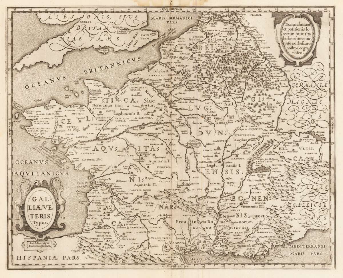
Galliae Veteris Typus
Joan Janssonius – Galliae Veteris Typus · Original Antique Copper Engraving, Uncoloured · Janssonius Joan. · Amsterdam 1649-60
Eigenschaften
- Published: Amsterdam
- Published date: 1649
- Issue date: 1649-60
- Technique: Copper engraving
- Type: map
- Category: Historic map of France
- Size: 39.5 x 49,5 cm (15.5 x 19,5 inches).
- Bibliography: Koeman I / 4000H:1B
- Stock number: 33311
- Condition: In good condition.
Article description
Article description
Original antique copper engraving, hand coloured when published, depicting Galliae Veteris Typus. Published by Janssonius Joan., Amsterdam, 1649-60. Sheet: 39.5 x 49,5 cm (15.5 x 19,5 inches).. A fine decorative example of antique cartography by Joan Janssonius, rich in period detail and historical significance. Johannes Janssonius (1588–1664), known in English as Jan Jansson, was a major Dutch cartographer and publisher based in Amsterdam. Born in Arnhem, he married into the Hondius family and collaborated with his brother-in-law Henricus Hondius to expand and improve the Mercator-Hondius atlas, competing directly with his great rival Joan Blaeu. Under Janssonius, the atlas grew from a few volumes to eleven, including atlases of maritime charts, ancient geography, and celestial maps. By 1660 the work bore the name Atlas Major and was one of the most comprehensive geographical publications of the age. Janssonius maps are characterised by fine engraving, elegant decorative borders, and vivid hand colour, and are among the most collected Dutch Golden Age maps. The map is ornated with a decorative title cartouche on the lower left side and a text cartouche in the upper right corner. Villages and towns are shown as miniature views. Marginal small water stains in the upper part of the double page map.Joan Janssonius – Galliae Veteris Typus · Original Antique Copper Engraving, Uncoloured · Janssonius Joan. · Amsterdam 1649-60
Koeman I / 4000H:1B
You might also be interested in the following products
 Artesia
 Original antique copper engraving, hand coloured when published, depicting Artois. Published by M. Seutter, Augsburg,...
€145.00
 Artesia. Iacobo...
 Original antique copper engraving, hand coloured when published, depicting Artois. Published in Antwerpen, 1588....
€295.00
 Elsass
 Original antique copper engraving, hand coloured when published, depicting Elsass - Alsatia. Published by Jodocus...
€240.00
 Li contorni di...
 Original antique copper engraving, hand coloured when published, depicting Paris. Published by Antonio Zatta.,...
€180.00
Recently viewed products