Robert, Sr.
Gouvernemens Généraux De la Marche, Du Limosin et de L´Auvergne. Par le Sr. Robert De Vaugondy.
Robert Sr – Gouvernemens Généraux De la Marche, Du Limosin et de L´Au... · Original Antique Copper Engraving, Hand Coloured · Sr. Robert · Paris 1753
Eigenschaften
- Published: Paris
- Published date: 1753
- Issue date: 1753
- Type: map
- Technique: Copper engraving / hand colored.
- Category: Atlantic coast with La Rochelle
- Size: 48 x 58.7 cm (19 x 23 inches).
- Stock number: 34585
- Condition: A very good copy. On the full sheet as published, printed and published 1753.
Article description
Article description
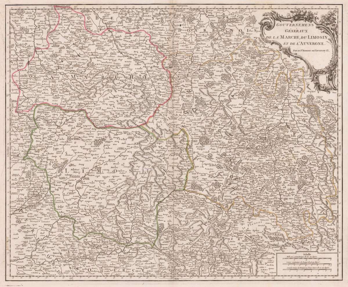
Original antique copper engraving, hand coloured when published, depicting Gouvernemens Généraux De la Marche, Du Limosin.... Published by Sr. Robert, Paris, 1753. Sheet: 48 x 58.7 cm (19 x 23 inches).. A fine decorative example of antique cartography by Robert Sr, rich in period detail and historical significance. Gilles Robert de Vaugondy (1688–1766) and his son Didier Robert de Vaugondy (c.1723–1786) were among the leading cartographers of eighteenth-century France. They were descended from the renowned cartographic dynasty of Nicolas Sanson and inherited much of his cartographic material. Their monumental Atlas Universel (1757), fifteen years in the making, was one of the most important geographical publications of the Enlightenment. In 1760, Didier was appointed Geographer to King Louis XV of France. The Robert de Vaugondy maps are prized for their scientific precision, elegant engraving, and the scholarly authority behind them — representing the peak of French cartographic achievement in the Age of Reason. Detailled map by the French cartographer Sr. Robert de Vaugondy. The map pretty much to date on the newest cartographic sources for this period around 1752-55. This is a beautiful 1753 map of the Limousin, Marche and Auvergne regions of France by Robert de Vaugondy. It shows from La Chatre in the south to Domme and from Perigueux in the east to Le Puy, covering all or part of the departments Haute Vienne, Indre, Creuse, Puy de Dome, Cantal, Correze, Dordogne and Lot. The map depicts the entire region in exceptional detail, providing both topographic and political information, with forests and mountains beautifully rendered in profile. The Creuse Regilon is known for its crazy cider e made from Limousin apples and its internationally renowned Limousin beef. In good condition for its age (published 1753). Colours well preserved. Some age-toning and minor imperfections consistent with a document of this antiquity. A condition report is available on request.Robert Sr – Gouvernemens Généraux De la Marche, Du Limosin et de L´Au... · Original Antique Copper Engraving, Hand Coloured · Sr. Robert · Paris 1753
You might also be interested in the following products
 Artesia
 Original antique copper engraving, hand coloured when published, depicting Artois. Published by M. Seutter, Augsburg,...
€145.00
 Artesia. Iacobo...
 Original antique copper engraving, hand coloured when published, depicting Artois. Published in Antwerpen, 1588....
€295.00
 Elsass
 Original antique copper engraving, hand coloured when published, depicting Elsass - Alsatia. Published by Jodocus...
€240.00
 Li contorni di...
 Original antique copper engraving, hand coloured when published, depicting Paris. Published by Antonio Zatta.,...
€180.00
Recently viewed products