Vogel, C.
Das Deutsche Reich und seine Nachbarländer. Zur Übersicht der Eisenbahnen und Dampfschiffahrten.
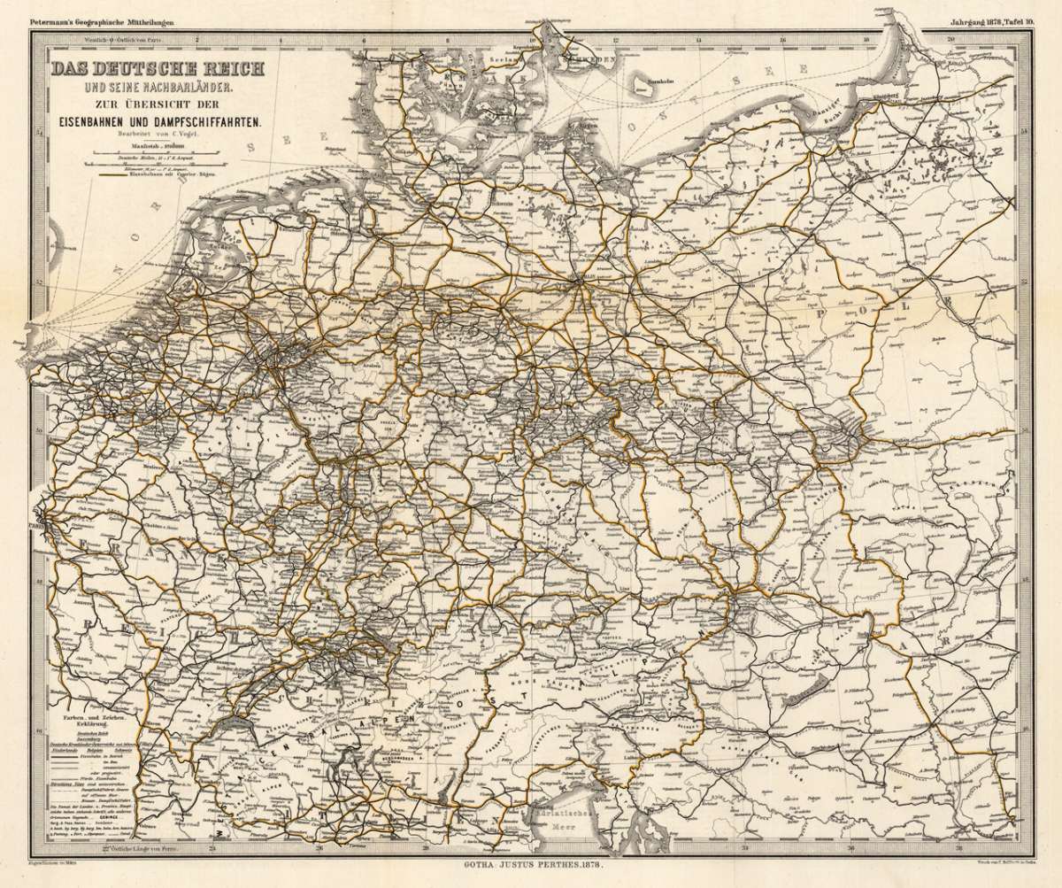
Das Deutsche Reich und seine Nachbarländer. Zur Übersicht der Eisenbahnen und Dampfschiffahrten. - C. Vogel ∑ Hand-Colored Original Steel Engraving ∑ Gotha 1874
Eigenschaften
- Published: Justus Perthes , Gotha
- Published date: 1874
- Type: Antique Map, map
- Issue date: 1874
- Category: Germany
- Technique: Lithograph / Original color
- Size: 335 by 410mm (13 by 16 inches).
- Stock number: 28607
- Condition: In excellent condition. The map was originally published folded, so that the old folds are still slightly visible. 335 by 410mm (13 by 16 inches).
Article description
Article description
Hand-Colored Original Steel Engraving by C. Vogel, depicting Das Deutsche Reich und seine Nachbarländer. Zur Übersicht der Eisenbahnen und Dampfschiffahrten.. Published Gotha, Justus Perthes, 1874. Sheet: 335 by 410mm (13 by 16 inches).. A fine and original hand-colored example of Vogel's celebrated cartographic work, documenting this region of Germany with the precision and decorative artistry characteristic of the 18700s. C. Vogel was a cartographer active in the 1800s, working in the tradition of European copper-engraved cartography. Their maps are valued by collectors for their historical accuracy and decorative quality. This original steel engraving, with original hand coloring depicts the region of Das Deutsche Reich und seine Nachbarländer. Zur Übersicht der Eisenbahnen und Dampfschiffahrten., published in Gotha, Justus Perthes, 1874. The map records the political and geographic boundaries of the region as understood in 1874, offering a fascinating window into the history of German territorial organization. Sheet measures 335 by 410mm (13 by 16 inches).. In good condition, showing expected signs of age. Ready to frame.Das Deutsche Reich und seine Nachbarländer. Zur Übersicht der Eisenbahnen und Dampfschiffahrten. - C. Vogel ∑ Hand-Colored Original Steel Engraving ∑ Gotha 1874
You might also be interested in the following products
 Trier - Koblentz...
 Hand-Colored Original Copperplate Engraving by Georg Braun & Franz Hogenberg, depicting Trier - Koblentz -...
€595.00
 Neus
Neus Hand-Colored Original Copperplate Engraving by Georg Braun & Franz Hogenberg, depicting Neus. Published Cologne,...
€745.00
 Campidonia vulgo...
 Hand-Colored Original Copperplate Engraving by Georg Braun & Franz Hogenberg, depicting Campidonia vulgo...
€850.00
 Novesium vulgo...
 Hand-Colored Original Copperplate Engraving by Georg Braun & Franz Hogenberg, depicting Novesium vulgo Neus; urbs...
€800.00
Recently viewed products