Ottens, Rainer & Josua
Ducatus Meklenburgicus in quo sunt Ducatus Vandaliae et Meklenburgi Comitatus et Episcopatus Swerinensis Rostochiense...
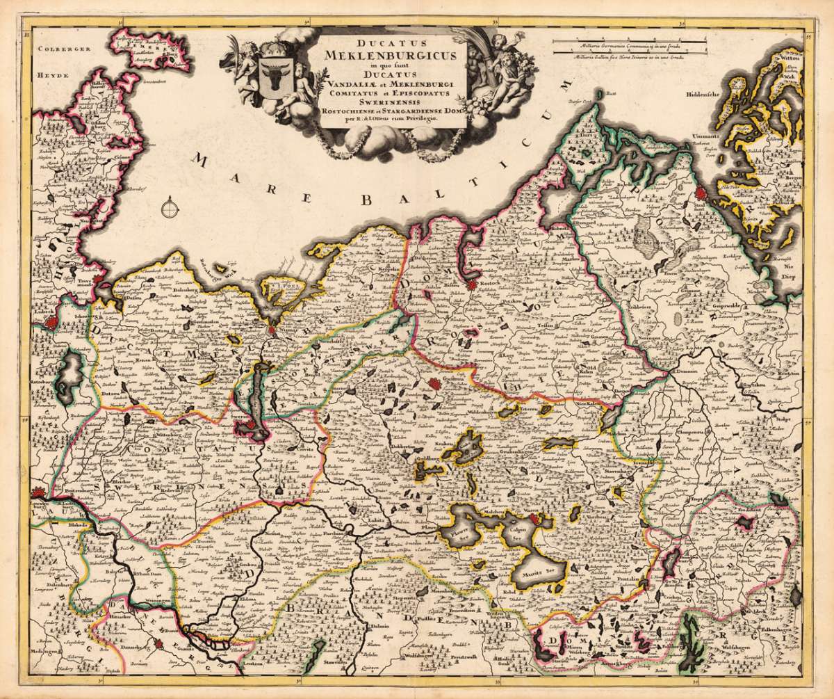
Ducatus Meklenburgicus in quo sunt Ducatus Vandaliae et Meklenburgi Comitatus et Episcopatus Swerinensis Rostochiense et Stargardiense Dom. - Rainer Ottens &...
Eigenschaften
- Published: Ottens Josua & Rainer , Amsterdam
- Published date: 1757
- Technique: Copper engraving / Original color.
- Type: Antique Map, map
- Issue date: 1757
- Category: Mecklenburg-Vorpommern
- Size: 510 by 600mm (20 by 23 inches).
- Stock number: 17565
- Condition: In excellent condition.
Article description
Article description
Hand-Colored Original Copperplate Engraving by Rainer Ottens & Josua, depicting Ducatus Meklenburgicus in quo sunt Ducatus Vandaliae et Meklenburgi Comitatus et Episcopatus Swerinensis Rostochiense et Stargardiense Dom.. Published Amsterdam, Ottens Josua & Rainer, 1757. Sheet: 510 by 600mm (20 by 23 inches).. A fine and original hand-colored example of Ottens's celebrated cartographic work, documenting this region of Germany with the precision and decorative artistry characteristic of the 17500s. Rainer Ottens (1698-1750) and Josua Ottens (1704-1765) were Amsterdam-based Dutch cartographic publishers, active from around 1710. They acquired plates from earlier publishers including de Wit and others, producing finely printed maps of European territories. Their maps continue the great Dutch tradition of cartographic excellence and are valued by collectors for their quality engraving and attractive coloring. This original copperplate engraving, with original hand coloring depicts the region of Ducatus Meklenburgicus in quo sunt Ducatus Vandaliae et Meklenburgi Comitatus et Episcopatus Swerinensis Rostochiense et Stargardiense Dom., published in Amsterdam, Ottens Josua & Rainer, 1757. The map features a decorative Baroque cartouche containing the title inscription. The map records the political and geographic boundaries of the region as understood in 1757, offering a fascinating window into the history of German territorial organization. Sheet measures 510 by 600mm (20 by 23 inches).. In good condition overall, with minor signs of age appropriate for a 18th-century engraving. Ready to frame.Ducatus Meklenburgicus in quo sunt Ducatus Vandaliae et Meklenburgi Comitatus et Episcopatus Swerinensis Rostochiense et Stargardiense Dom. - Rainer Ottens &...
You might also be interested in the following products
 Marchionatus...
 Hand-Colored Original Etching by Matth us Seutter, depicting Marchionatus Brandenburgensis Ducatus Pomeraniae et...
€245.00
 Marchionatus...
 Hand-Colored Original Copperplate Engraving by Jean Covens & Cornelius Mortier, depicting Marchionatus...
€320.00
 Ducatus...
 Hand-Colored Original Copperplate Engraving by Frederick de Wit, depicting Ducatus Meklenburgicus in quo sunt Ducatus...
€400.00
 The N.E. Part of...
 Hand-Colored Original Copperplate Engraving by Herman Moll, depicting The N.E. Part of Germany Containing the...
€145.00
Recently viewed products