Weigel, Christoph
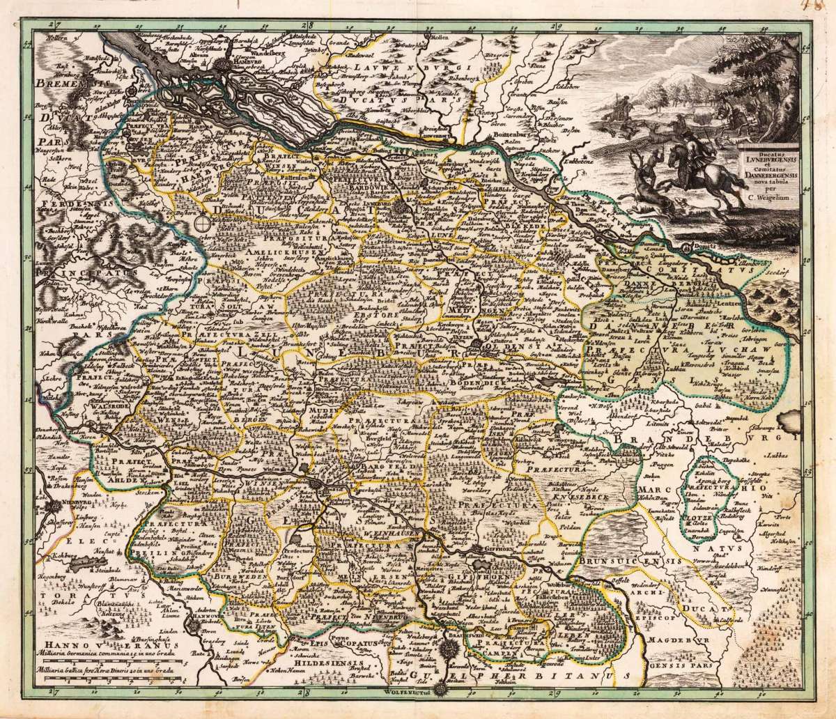
Ducatus Luneburgensis et Comitatus Dannebergensis nova tabula per C. Weigelium.
Ducatus Luneburgensis et Comitatus Dannebergensis nova tabula per C. Weigelium. - Christoph Weigel ∑ Hand-Colored Original Copperplate Engraving ∑ Nürnberg 1720
Eigenschaften
- Published: Chr. Weigel. , Nürnberg
- Published date: 1720
- Technique: Copper engraving / Original color.
- Type: Antique Map, map
- Issue date: 1720-40
- Category: Lüneburg
- Size: 325 by 381mm (12 by 15 inches).
- Stock number: 19497
- Condition: In excellent condition. 325 by 381mm (12 by 15 inches).
Article description
Article description
Hand-Colored Original Copperplate Engraving by Christoph Weigel, depicting Ducatus Luneburgensis et Comitatus Dannebergensis nova tabula per C. Weigelium.. Published Nürnberg, Chr. Weigel., 1720. Sheet: 325 by 381mm (12 by 15 inches).. A fine and original hand-colored example of Weigel's celebrated cartographic work, documenting this region of Germany with the precision and decorative artistry characteristic of the 17200s. Christoph Weigel (1654-1725) was a German engraver, art dealer, and publisher based in Nuremberg. He was one of the most active publishers of illustrated books and maps in early 18th-century Germany, producing maps, city views, and topographic prints of high quality. His maps of German territories are distinguished by their careful engraving and are valued by collectors for their historical accuracy and decorative appeal. This original copperplate engraving, with original hand coloring depicts the region of Ducatus Luneburgensis et Comitatus Dannebergensis nova tabula per C. Weigelium., published in Nürnberg, Chr. Weigel., 1720-40. The map features a decorative Baroque cartouche containing the title inscription. A distance scale is incorporated within the cartouche or alongside it. The cartouche is elaborated with allegorical or figural ornamentation. The map records the political and geographic boundaries of the region as understood in 1720-40, offering a fascinating window into the history of German territorial organization. Sheet measures 325 by 381mm (12 by 15 inches).. In good condition overall, with minor signs of age appropriate for a 18th-century engraving. Ready to frame.Ducatus Luneburgensis et Comitatus Dannebergensis nova tabula per C. Weigelium. - Christoph Weigel ∑ Hand-Colored Original Copperplate Engraving ∑ Nürnberg 1720
You might also be interested in the following products
 Niedersachsen
 Hand-Colored Original Copperplate Engraving by Gerard Mercator, depicting Niedersachsen. Published Amsterdam, Jodocus...
€300.00
 Episcopatuum...
 Hand-Colored Original Copperplate Engraving by Matthäus Seutter, depicting Episcopatuum Monasteriensis Et...
€495.00
 Saxoniae...
 Hand-Colored Original Copperplate Engraving by Matthäus Seutter, depicting Saxoniae Inferioris Circulus juxta...
€300.00
 Ducatus...
 Hand-Colored Original Copperplate Engraving by Matthäus Seutter, depicting Ducatus Luneburgicus cum Comitatu...
€275.00
Recently viewed products