Gray, Frank
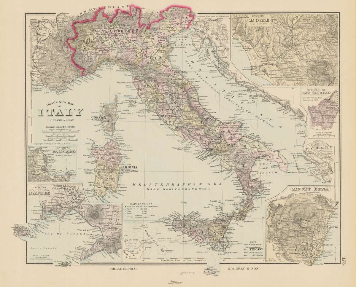
Gray's New Map of Italy
Gray, Frank – Rome & Latium · Lithograph, Hand Colored · Gray's New Atlas, Philadelphia · 1884
Eigenschaften
- Published: Philadelphia
- Published date: 1884
- Technique: Lithograph / Original color.
- Issue date: 1884
- Category: Italy
- Type: map
- Size: 330 by 400mm (13 by 15 inches).
- Stock number: 14747
- Condition: In excellent condition.
Article description
Article description
Original antique hand-colored lithograph, published 1884. Depicting Rome & Latium, this map is a fine example of 0s European cartography. Image: 330 by 400mm (13 by 15 inches). An attractive and historically significant 19th-century map for the discerning collector. Gray, Frank was an active cartographer and publisher of the period, producing maps that combined geographic accuracy with the decorative qualities typical of the era. Detailed map, colored by counties and showing townships, towns, villages, post offices, canals, roads, railroads (projected and completed), towns, etc. In the lower left corner 2 insets show the environs of Palerme and Naples. Two further insets are found in the upper right corner showing the environs of Rome and the Republic of San Marino. Additionally you find a map of the Mount Etna in the lower right corner. A highly detailed map. A fine example from Gray's New Atlas, Philadelphia, sought after by collectors of antique maps of Italy, antique maps of Rome, and antique hand-colored lithographs for sale. In good condition. Colors well-preserved.Gray, Frank – Rome & Latium · Lithograph, Hand Colored · Gray's New Atlas, Philadelphia · 1884
You might also be interested in the following products
 Pedemontanae...
 Original antique copper engraving, uncolored, from the 'Theatrum Orbis Terrarum' by Abraham Ortelius, the...
€650.00
 Naples & Sicily
 Original antique lithograph, published 1852. Depicting Kingdom of Naples, this map is a fine example of 0s European...
€145.00
 Milane States
 Original antique hand-colored lithograph, published 1852. Depicting Milan & Lombardy, this map is a fine example...
€140.00
 Les Environs De...
 Original antique hand-colored copper engraving, published 1700. Depicting Kingdom of Naples, this map is a fine...
€170.00
Recently viewed products