Fer, de Nicolaus.
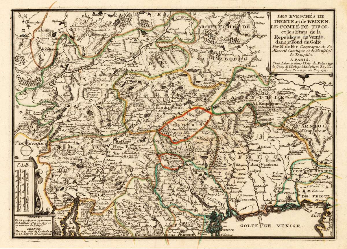
Les Eveschés De Trente, et de Brixen. Le Comté de Tirol et les Etats de la Republique de Venise dans le Fond du...
Fer, de – Tyrol & Trentino · Copper Engraving, Hand Colored · Introduction à la Géographie, Paris · 1705
Eigenschaften
- Published: N. de Fer , Paris
- Published date: 1705
- Technique: Copper engraving / Original color.
- Type: Antique Map, map
- Category: Northern Italy
- Issue date: 1705
- Size: 252 by 352mm (10 by 13 inches).
- Stock number: 15715
- Condition: Full margins as published. 252 by 352mm (10 by 13 inches).
Article description
Article description
Original antique hand-colored copper engraving, published 1705. Depicting Tyrol & Trentino, this map is a fine example of 0s European cartography. Image: 252 by 352mm (10 by 13 inches). An attractive and historically significant 18th-century map for the discerning collector. Nicolas de Fer (1646–1720) was a prominent French cartographer, engraver, and publisher based in Paris. After inheriting his father's mapmaking business, de Fer built it into one of the most productive cartographic firms in France, eventually becoming Geographer to King Louis XIV of France and King Philip V of Spain. His output was prolific—more than 600 sheet maps, town plans, and atlases—covering Europe, the Americas, and beyond. De Fer's maps are known for their decorative cartouches, attractive hand coloring, and commercial appeal, though they were sometimes criticized for prioritizing artistry over accuracy. His maps are particularly associated with the campaigns of the War of the Spanish Succession and are sought by collectors for their decorative quality. Ornated in the lower left corner with a small milage scale. A fine example from Introduction à la Géographie, Paris, sought after by collectors of antique maps of Italy, antique maps of Tyrol, and antique hand-colored copper engravings for sale. In very good condition. Light age-toning to the sheet, as expected for a 18th-century map.Fer, de – Tyrol & Trentino · Copper Engraving, Hand Colored · Introduction à la Géographie, Paris · 1705
You might also be interested in the following products
 Pedemontanae...
 Original antique copper engraving, uncolored, from the 'Theatrum Orbis Terrarum' by Abraham Ortelius, the...
€650.00
 Naples & Sicily
 Original antique lithograph, published 1852. Depicting Kingdom of Naples, this map is a fine example of 0s European...
€145.00
 Milane States
 Original antique hand-colored lithograph, published 1852. Depicting Milan & Lombardy, this map is a fine example...
€140.00
 Les Environs De...
 Original antique hand-colored copper engraving, published 1700. Depicting Kingdom of Naples, this map is a fine...
€170.00
Recently viewed products