Kiepert, H.
Italien
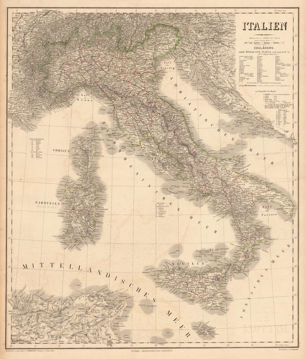
Kiepert, H. – Italy · Steel Engraving, Hand Colored · published by Geographisches Institut, Weimar · 1865
Eigenschaften
- Published: Geographisches Institut , Weimar
- Published date: 1865
- Type: Antique Map, map
- Issue date: 1865
- Category: Italy
- Technique: Steelengraving, original colour
- Size: 633 by 543mm (25 by 21 inches).
- Stock number: 19078
- Condition: In excellent condition.
Article description
Article description
Original antique hand-colored steel engraving, published 1865. Depicting Italy, this map is a fine example of 0s European cartography. Image: 633 by 543mm (25 by 21 inches). An attractive and historically significant 19th-century map for the discerning collector. Heinrich Kiepert (1818–1899) was a leading German geographer and cartographer, associated with the Geographical Institute in Weimar. He specialized in the historical and physical geography of the ancient world and 19th-century Europe, producing authoritative maps widely used in academic and educational settings. His maps of Italy, revised and updated across multiple editions, represent some of the most accurate mid-19th-century cartographic surveys of the peninsula. Kiepert's work is represented in major German research libraries. Large and detailed map of Italy drawn by H. Kiepert and revised by C. Gräf in 1865. The map is very detailed and provides a lot of information on cities and place names, streets, rivers, mountains railroads, ports, etc. Also the political borders of small regions are shown in outline colors. Equipped next to the title with an extensive table of explanations. A fine example from published by Geographisches Institut, Weimar, sought after by collectors of antique maps of Italy, antique maps of Italy, and antique hand-colored steel engravings for sale. In good condition. Colors well-preserved.Kiepert, H. – Italy · Steel Engraving, Hand Colored · published by Geographisches Institut, Weimar · 1865
You might also be interested in the following products
 Pedemontanae...
 Original antique copper engraving, uncolored, from the 'Theatrum Orbis Terrarum' by Abraham Ortelius, the...
€650.00
 Naples & Sicily
 Original antique lithograph, published 1852. Depicting Kingdom of Naples, this map is a fine example of 0s European...
€145.00
 Milane States
 Original antique hand-colored lithograph, published 1852. Depicting Milan & Lombardy, this map is a fine example...
€140.00
 Les Environs De...
 Original antique hand-colored copper engraving, published 1700. Depicting Kingdom of Naples, this map is a fine...
€170.00
Recently viewed products