Eigenschaften
- Published: C. Flemming , Glogau
- Published date: 1845
- Type: Antique Map, map
- Technique: Lithograph / Original color.
- Issue date: 1845
- Category: Italy
- Size: 338 by 277mm (13 by 11 inches).
- Stock number: 19081
- Condition: In very good condition. At the left side a small marginal mended tear, not affecting the image. 338 by 277mm (13 by 11 inches).
Article description
Article description
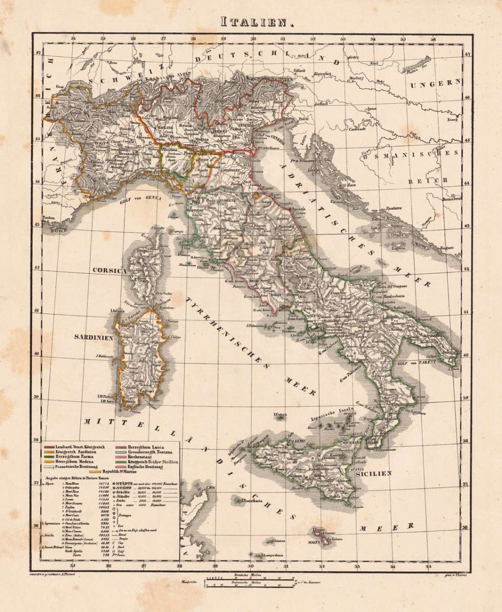
Original antique hand-colored lithograph, published 1845. Depicting Sicily, this map is a fine example of 0s European cartography. Image: 338 by 277mm (13 by 11 inches). An attractive and historically significant 19th-century map for the discerning collector. A. Theinert was a German cartographer active in the mid-19th century, producing maps for the publisher C. Flemming in Glogau. His map of Italy and Sicily provides a detailed overview of the peninsula in the pre-Unification period, with careful attention to the political divisions of the Italian states. Interesting German map of Italy and Sicily with the kingdom of Sardinia. With engraved place names, rivers and mountains. In the lower left corner a table with explanations and the different colors to explain the political possessions. A fine example from published Glogau, sought after by collectors of antique maps of Italy, antique maps of Sicily, and antique hand-colored lithographs for sale. In good condition. Colors well-preserved.Theinert, A. – Sicily · Lithograph, Hand Colored · published Glogau · 1845
You might also be interested in the following products
 Pedemontanae...
 Original antique copper engraving, uncolored, from the 'Theatrum Orbis Terrarum' by Abraham Ortelius, the...
€650.00
 Naples & Sicily
 Original antique lithograph, published 1852. Depicting Kingdom of Naples, this map is a fine example of 0s European...
€145.00
 Milane States
 Original antique hand-colored lithograph, published 1852. Depicting Milan & Lombardy, this map is a fine example...
€140.00
 Les Environs De...
 Original antique hand-colored copper engraving, published 1700. Depicting Kingdom of Naples, this map is a fine...
€170.00
Recently viewed products