Migeon, J.
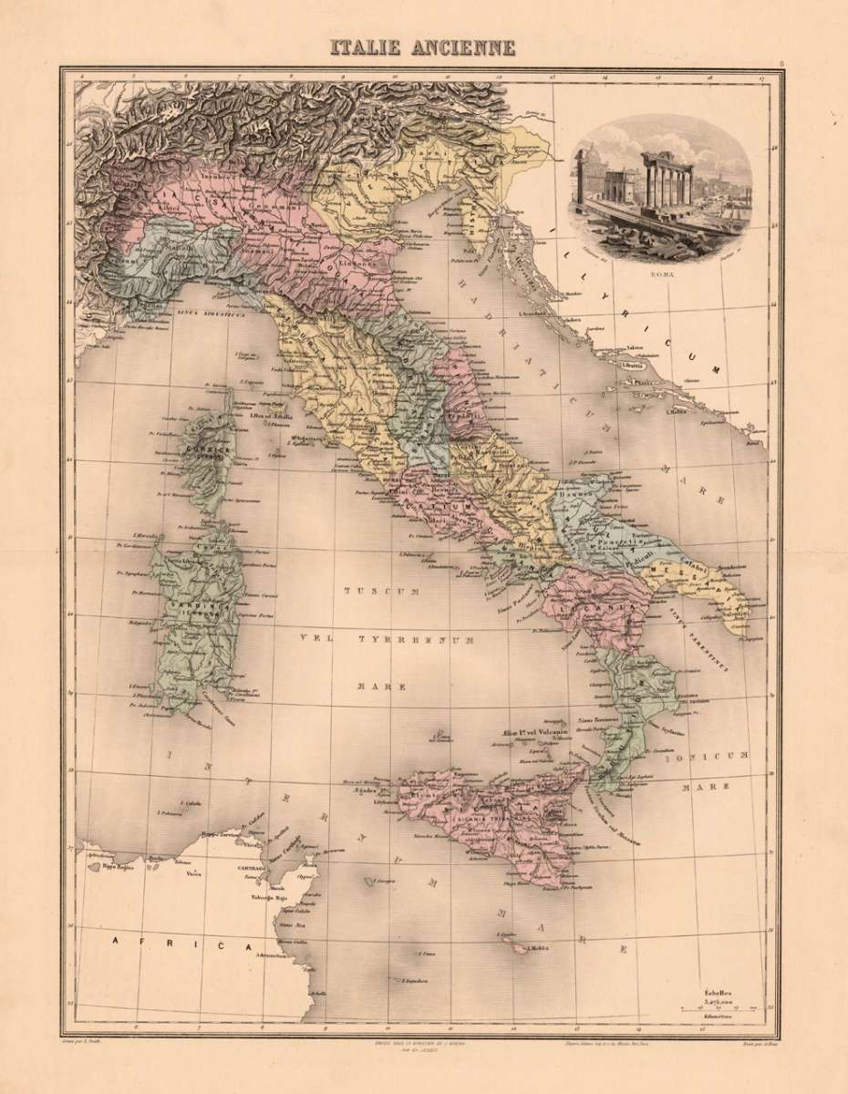
Italie Ancienne
Migeon, J. – Rome & Latium · Steel Engraving, Hand Colored · published Paris · 1865
Eigenschaften
- Published: J. Migeon , Paris
- Published date: 1865
- Type: Antique Map, map
- Technique: Steel engraving, original color
- Issue date: 1865
- Category: Antique Italy
- Size: 423 by 315mm (16 by 12 inches).
- Stock number: 19082
- Condition: In excellent condition. 423 by 315mm (16 by 12 inches).
Article description
Article description
Original antique hand-colored steel engraving, published 1865. Depicting Rome & Latium, this map is a fine example of 0s European cartography. Image: 423 by 315mm (16 by 12 inches). An attractive and historically significant 19th-century map for the discerning collector. J. Migeon was a French cartographer and engraver active in Paris in the mid-19th century, known for his maps of ancient and modern geography. His map of 'Italie Ancienne' (Ancient Italy) illustrates the historical geography of the Italian peninsula in classical antiquity, combining topographic accuracy with the study of ancient place names and boundaries—a popular subject for Victorian-era classical scholars and collectors. Detailed map of the Antique Italy, Sicily and Sardinia with engraved names of historical places. Rivers and mountains are as well engraved. The different regions in Italy are named accurately. In the upper right corner an engraved view of antiquities of 'Rome'. This small and decorative historic map should not be missing in a map collection. A fine example from published Paris, sought after by collectors of antique maps of Italy, antique maps of Rome, and antique hand-colored steel engravings for sale. In good condition. Colors well-preserved.Migeon, J. – Rome & Latium · Steel Engraving, Hand Colored · published Paris · 1865
You might also be interested in the following products
 Pedemontanae...
 Original antique copper engraving, uncolored, from the 'Theatrum Orbis Terrarum' by Abraham Ortelius, the...
€650.00
 Naples & Sicily
 Original antique lithograph, published 1852. Depicting Kingdom of Naples, this map is a fine example of 0s European...
€145.00
 Milane States
 Original antique hand-colored lithograph, published 1852. Depicting Milan & Lombardy, this map is a fine example...
€140.00
 Les Environs De...
 Original antique hand-colored copper engraving, published 1700. Depicting Kingdom of Naples, this map is a fine...
€170.00
Recently viewed products