Petermann, A.
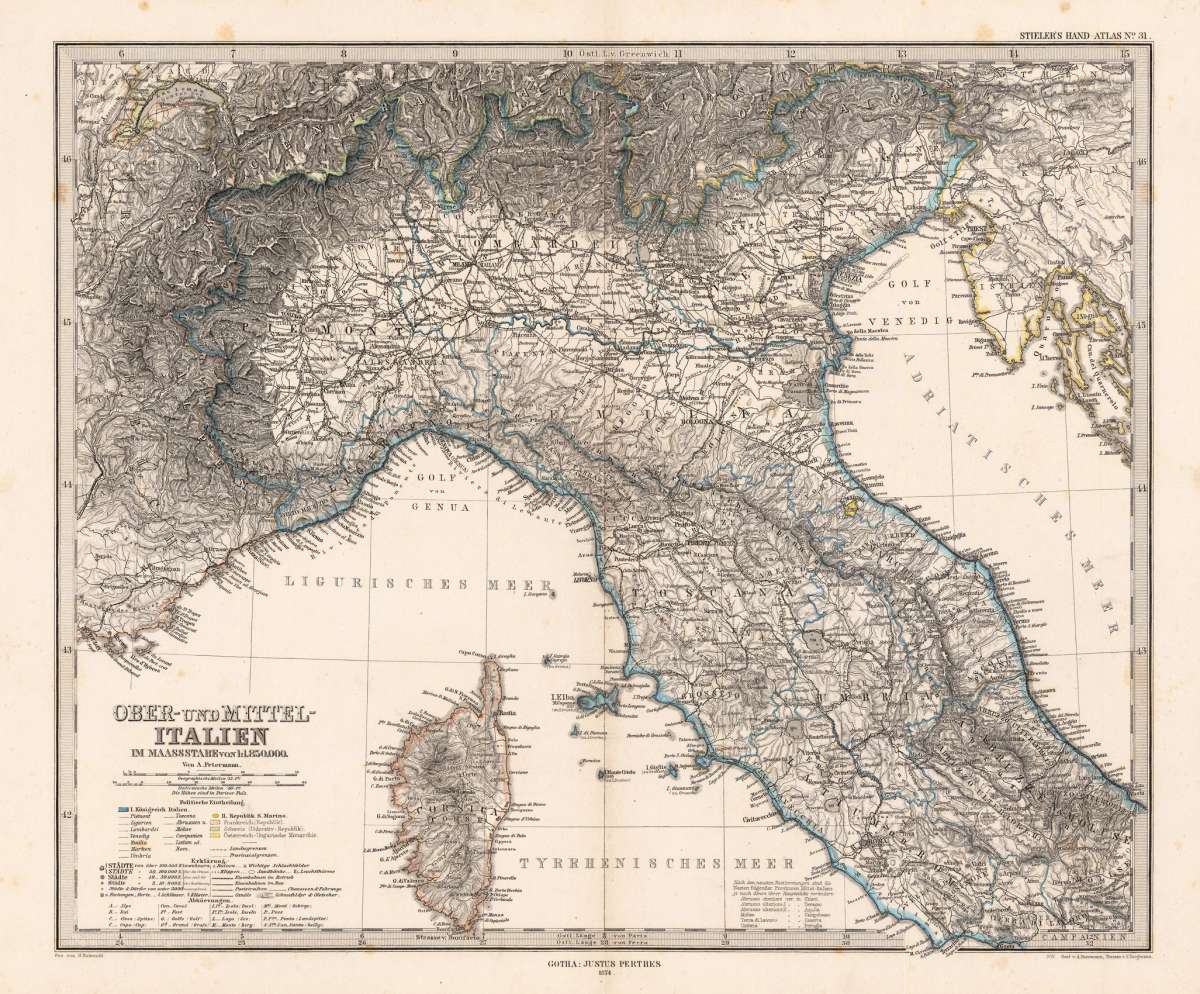
Ober- und Mittel-Italien im Maassstabe von 1:1.850.000. - Von A. Petermann.
Petermann, A. – Northern Italy · Steel Engraving, Hand Colored · Petermanns Geographische Mitteilungen, Gotha · 1874
Eigenschaften
- Published: Justus Perthes. , Gotha
- Published date: 1874
- Type: Antique Map, map
- Technique: Steel engraving, original color
- Category: Northern Italy
- Issue date: 1874
- Size: 335 by 405mm (13 by 16 inches).
- Stock number: 19089
- Condition: In very good condition. 335 by 405mm (13 by 16 inches).
Article description
Article description
Original antique hand-colored steel engraving, published by Justus Perthes in Gotha for Petermanns Geographische Mitteilungen, 1874. Depicting Northern Italy, this map is a fine example of 1870s European cartography. Image: 335 by 405mm (13 by 16 inches). An attractive and historically significant 19th-century map for the discerning collector. August Heinrich Petermann (1822–1878) was one of the most important German cartographers and geographers of the 19th century. After training in Gotha under Heinrich Berghaus, he spent time in Britain before returning to Gotha to found 'Petermanns Geographische Mitteilungen' (1855), which became one of the world's leading geographic journals. Published by Justus Perthes in Gotha, Petermann's maps are celebrated for their scientific rigor, thematic innovation, and beautiful steel engraving. He was a pioneer of thematic cartography—creating maps that visualized statistical data such as emigration, population, and disease. Petermann maps are held in major research libraries and are prized by collectors of 19th-century scientific cartography. Detailed map of Northern Italy and Corsica, equipped with several tables of explanantions in the lower left corner. The map is pretty detailed with engraved small place names, streets, mountains and rivers. A fine example from Petermanns Geographische Mitteilungen, Gotha, sought after by collectors of antique maps of Italy, antique maps of Northern Italy, and antique hand-colored steel engravings for sale. In good condition. Colors well-preserved.Petermann, A. – Northern Italy · Steel Engraving, Hand Colored · Petermanns Geographische Mitteilungen, Gotha · 1874
You might also be interested in the following products
 Pedemontanae...
 Original antique copper engraving, uncolored, from the 'Theatrum Orbis Terrarum' by Abraham Ortelius, the...
€650.00
 Naples & Sicily
 Original antique lithograph, published 1852. Depicting Kingdom of Naples, this map is a fine example of 0s European...
€145.00
 Milane States
 Original antique hand-colored lithograph, published 1852. Depicting Milan & Lombardy, this map is a fine example...
€140.00
 Les Environs De...
 Original antique hand-colored copper engraving, published 1700. Depicting Kingdom of Naples, this map is a fine...
€170.00
Recently viewed products