Kiepert, H.
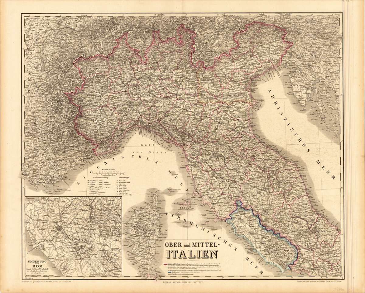
Ober und Mittel- Italien
Kiepert, H. – Rome & Latium · Steel Engraving, Hand Colored · published by Geographisches Institut, Weimar · 1866
Eigenschaften
- Published: Geographisches Institut , Weimar
- Published date: 1866
- Type: Antique Map, map
- Category: Northern Italy
- Issue date: 1866
- Technique: Steelengraving, original colour
- Size: 513 by 619mm (20 by 24 inches).
- Stock number: 19100
- Condition: In excellent condition. 513 by 619mm (20 by 24 inches).
Article description
Article description
Original antique hand-colored steel engraving, published 1866. Depicting Rome & Latium, this map is a fine example of 0s European cartography. Image: 513 by 619mm (20 by 24 inches). An attractive and historically significant 19th-century map for the discerning collector. Heinrich Kiepert (1818–1899) was a leading German geographer and cartographer, associated with the Geographical Institute in Weimar. He specialized in the historical and physical geography of the ancient world and 19th-century Europe, producing authoritative maps widely used in academic and educational settings. His maps of Italy, revised and updated across multiple editions, represent some of the most accurate mid-19th-century cartographic surveys of the peninsula. Kiepert's work is represented in major German research libraries. Large and detailed map of Northern & Central Italy drawn by H. Kiepert and revised by C. Gräf in 1866. The map is very detailed and provides a lot of information on cities and place names, streets, rivers, mountains railroads, ports, etc. Also the political borders of small regions are shown in outline colors. Equipped with a inset map of the surrounding of Rome. As well a table of explanations. A fine example from published by Geographisches Institut, Weimar, sought after by collectors of antique maps of Italy, antique maps of Rome, and antique hand-colored steel engravings for sale. In good condition. Colors well-preserved.Kiepert, H. – Rome & Latium · Steel Engraving, Hand Colored · published by Geographisches Institut, Weimar · 1866
You might also be interested in the following products
 Pedemontanae...
 Original antique copper engraving, uncolored, from the 'Theatrum Orbis Terrarum' by Abraham Ortelius, the...
€650.00
 Naples & Sicily
 Original antique lithograph, published 1852. Depicting Kingdom of Naples, this map is a fine example of 0s European...
€145.00
 Milane States
 Original antique hand-colored lithograph, published 1852. Depicting Milan & Lombardy, this map is a fine example...
€140.00
 Les Environs De...
 Original antique hand-colored copper engraving, published 1700. Depicting Kingdom of Naples, this map is a fine...
€170.00
Recently viewed products