Sanson, Nicolas d'Abbeville
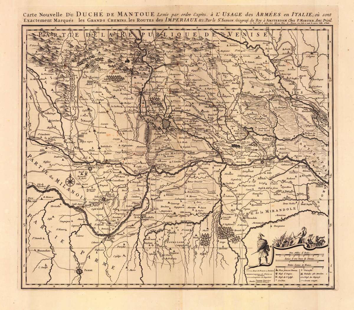
Carte Nouvelle du Duché de Mantoue Leyée par ordre Exprés. á L´Usage des Armées en Italie; ou sont Exactement Marqués...
Eigenschaften
- Published: Pierre Mortier , Amsterdam
- Published date: 1693
- Type: Antique Map, map
- Technique: Copper engraving / Uncolored
- Issue date: 1693-1700
- Category: Mantua
- Size: 490 by 580mm (19¼ by 22¾ inches).
- Stock number: 19103
- Condition: A strong impression in excellent condition. 490 by 580mm (19¼ by 22¾ inches).
Article description
Article description
Copper engraving, uncolored as published. Large detailed and interesting map by the famous French cartographer Nicolaus Sanson published in the famous sea atlas 'Le Neptune francois ...' in Amsterdam at Pierre Mortier. This interesting and large map was originally first published in the 'Atlas Noveau ...' by Alexis Hubert Jaillot & N. Sanson in Paris 1683-89. Alexis Hubert Jaillot & Nicolaus Jaillot worked as a royal cartographers for the French royal house for king Louis XIV. His maps published for the 'Atlas Nouveau ...' can be regarded as masterpieces of cartography in France in the ending 18th century. Also the maps impress by their accuracy and are providing an enormous amount of place names, monasteries, rivers, trails, fortifications, etc. Shown is the duchy of Mantua (Mantova) in Northern Italy. Mantua is shown prominently in the center of the map. The map provides many place names, detailed information on the river system also in the lower right corner a cartouche with a mileage scale and a table of explanations.You might also be interested in the following products
 Pedemontanae...
 Original copper engraving, uncolored as published, 1575 in a Latin text edition of the Atlas "Theatrum Orbis...
€650.00
 Ora Baiana et...
 Original antique copper engraving, hand colored in outline and wash when published. Decorativ map of the Bay of...
€175.00
 Naples & Sicily
 Lithograph, original color in outline. A large decorative and detailed map showing southern Italy with Naples,...
€145.00
 Milane States
 Lithograph, handcolored in outline, when published. Decorative map of the Milanese states by G. Philip & Son,...
€140.00
Recently viewed products