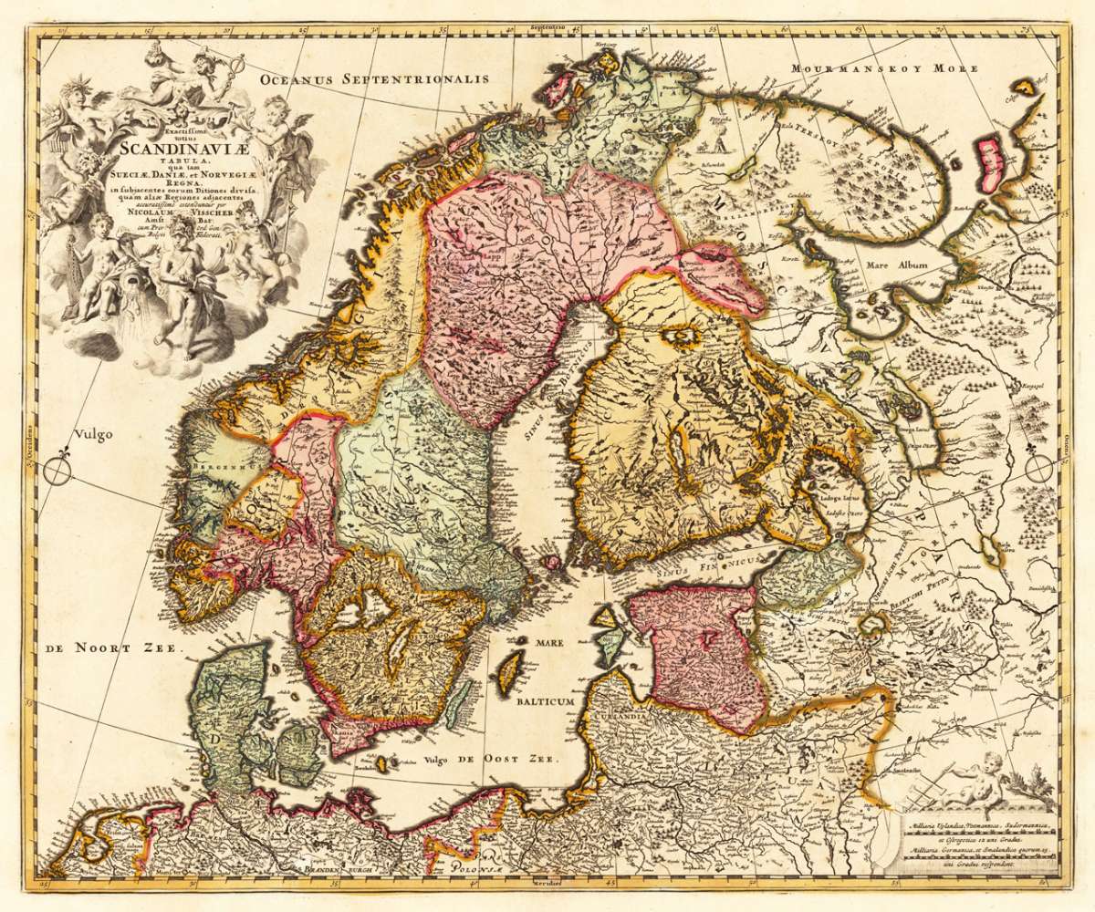
Visscher, Nicolaus
Exactissima totius Scandinaviae Tabula, qua tam Sueciae, Daniae, et Norvegiae Regna, in subjacentes eorum Ditiones...
Eigenschaften
- Published: Amsterdam
- Published date: 1680
- Technique: Copper engraving / Original color.
- Type: Antique Map, map
- Category: Scandinavia
- Issue date: 1680-90
- Size: 440 by 528mm (17 by 20 inches).
- Stock number: 23965
- Condition: Due of the old oxidation in the old colors, the reverse side of the map was carefully filled with paper fibers. In very good to excellent condition. 440 by 528mm (17 by 20 inches).
Article description
Article description
Copper engraving, hand colored in outline and wash. Nicolaes Visscher (25 January 1618, Amsterdam – buried 11 September 1679, Amsterdam) was a Dutch engraver, cartographer and publisher. He was the son of Claes Janszoon Visscher. His son, Nicolaes Visscher II (1649–1702), also worked with him and continued the family tradition of mapmaking after his death. Visscher died in Amsterdam in 1679 and was buried in the Nieuwezijds Kapel on 11 September of that year, though a death year of 1709 is maintained by some sources. His engraved double hemisphere map, Orbis Terrarum Nova et Accuratissima Tabula, was created in 1658 in Amsterdam. It also contains smaller northern and southern polar projections. The border is decorated with mythological scenes, one in each corner, drawn by the painter Nicolaes Berchem, showing Zeus, Neptune, Persephone and Demeter. It is an early example of highly decorated Dutch world maps. (Wikipedia)You might also be interested in the following products
 Moluccae Insulae...
 Original antique copper engraving, hand colored in outline and wash when published. A highly decorative map of the...
€550.00
 Pascaert van...
 Original antique copper engraving, uncolored as published. Detailed chart of the Northeastern part of Canada,...
€1,750.00
 Pascaarte vande...
 Copper Engraving, uncolored by van Keulen, Joan, published 1684-1704 by Johannes van Keulen, Amsterdam. Image size:...
€1,100.00
 Neueste Karte von...
 Original steel engraving engraved and drawn by Capt. Radefeld, published in Meyer's Handatlas, hand colored in...
€120.00
Recently viewed products