Weiland, Carl Ferdinand
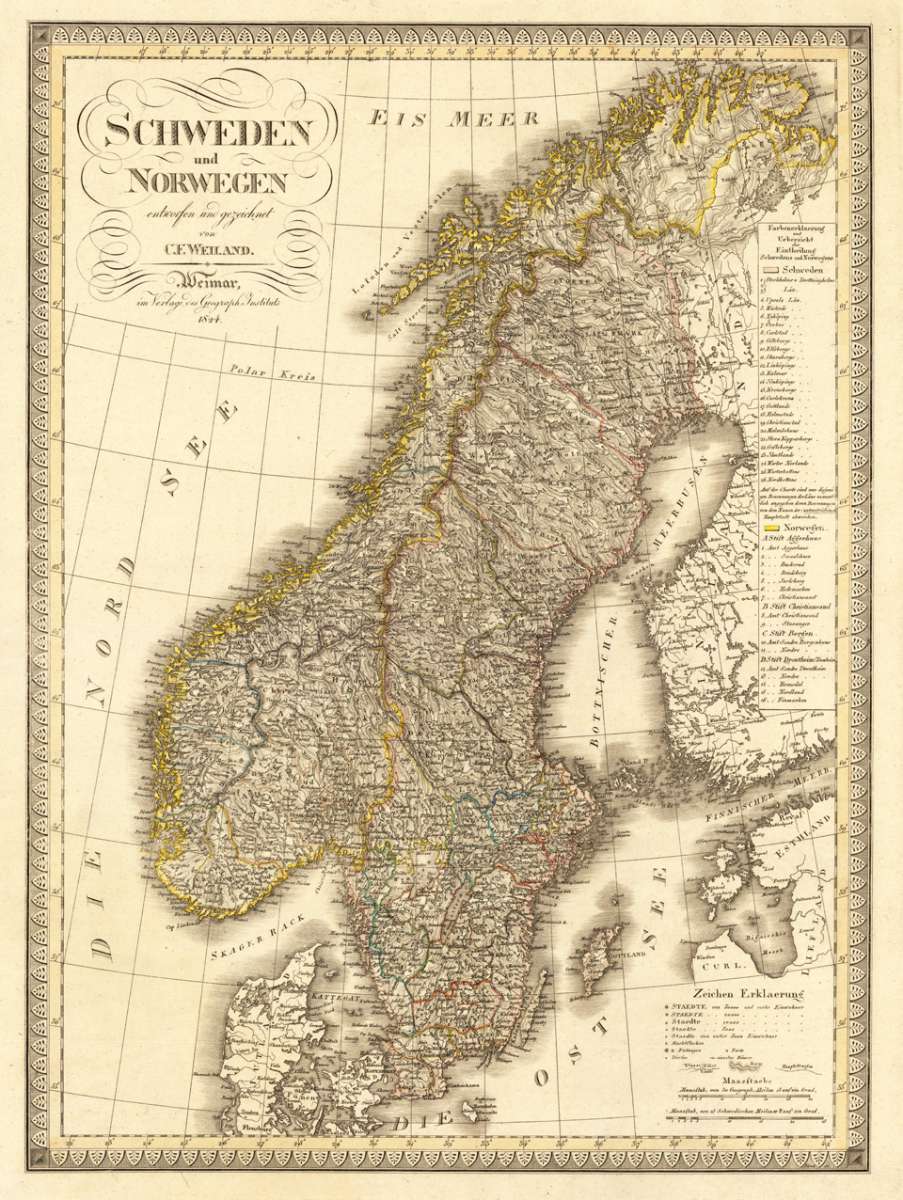
Schweden und Norwegen entworfen und gezeichnet von C. F. Weiland. Weimar, im Verlage des Geograph. Instituts 1824.
Eigenschaften
- Published: Verlag des Geographischen Instituts , Weimar
- Published date: 1824
- Type: Antique Map, map
- Issue date: 1824
- Technique: Copper engraving / Original color
- Category: Sweden and Norway
- Size: 600 by 443mm (23½ by 17½ inches).
- Stock number: 29367
- Condition: In excellent condition. 600 by 443mm (23½ by 17½ inches).
Article description
Article description
Copper engraving, hand colored in outline when published. The fine engraved map of Scandinavia with Sweden, Norway and parts of Denmark, Finland and Estonia is surrounded with a decorative border. At the upper left corner we find the engraved title and in the lower right corner is a table with explanations of inhabitants, as well fortresses and villages. Above we find an overview and with a classification of cities and towns in Sweden and Norway to explain the deviations of the various cities names on this map.You might also be interested in the following products
 Fionia
 Original antique copper engraving, uncolored. Published in the first Cloppenburgh edition of Gerhard Mercator's...
€150.00
 Südliches...
 Published in Meyer's "Handatlas", a very good copy in contemporary hand color in outline. Detailed...
€100.00
 Neueste Karte von...
 Original steel engraving engraved and drawn by Capt. Radefeld, published in Meyer's Handatlas, hand colored in...
€120.00
 De Custen van...
 Detailled seachart of a part of the Baltic Sea with the Southern Swedish coast from Schoenen towards Calmer with the...
€1,450.00
Recently viewed products