Homann, Johann Baptist
Imperii-Romano-Germanici in suos Status et Circulos divisi Tabula Generalis in Usus Inventutis erudiendae accomodata...
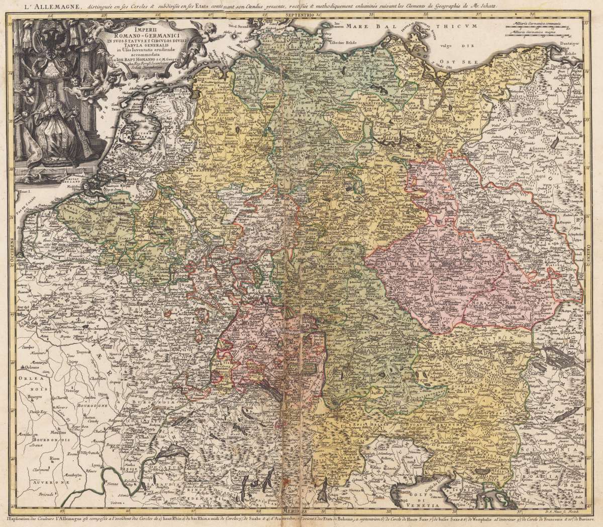
Eigenschaften
- Published: Nürnberg
- Published date: 1741
- Issue date: 1741
- Technique: Copper engraving
- Type: map
- Category: Holy-Roman-Empire
- Size: 467 by 547mm (18½ by 21½ inches).
- Stock number: 34568
- Condition: Center fold with some damage.
Article description
Article description
Original copper engraving, hand colored in outline and wash when published. The map depicts the Holy Roman Empire around 1741. It shows Germany, Austria, Bohemia and parts of the Low Countries with its political borders hand colored when published in outline and wash belonging to the Holy-Roman-Empire. Further the map includes parts of the neighboring countries as France, Switzerland, Northern Italy, Prussia and Poland and Hungary. A detailed antique map with many engraved place names, rivers, lakes, mountains. In the upper left corner with decorative title cartouche showing the emperor of the Holy-Roman-Empire (Karl VII.) surrounded by puttos and above the eagle of the Holy Roman Empire.You might also be interested in the following products
 Germania Antiqua
 Hand-Colored Original Copperplate Engraving by Samuel John Neele, depicting Germania Antiqua. Published London,...
€150.00
 L´Empire...
 Decorative original copper engraving with contemporary outline color, showing the Holy Roman Empire with its states,...
€120.00
 Germania...
 Original Kupferstich in zeitgenössischem Grenz- und Flächenkolorit. Dargestellt wird Deutschland, Polen, Böhmen,...
€290.00
 Germania...
 Original antiker Kupferstich in späterem Handkolorit. Diese kleine dekorative Landkarte zeigt Deutschland und Teile...
€145.00
Recently viewed products