The following products have been found matching your search "greenland": 25
Or did you mean: griechenland | griechenlandt | groenland | groenlande | groenlandia | grenzlande | groenlands | homann griechenland
No results were found for the filter!
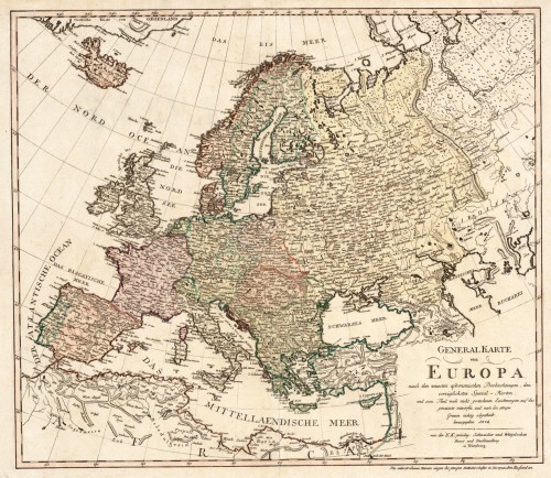
 Generalkarte von Europa, nach den neuesten astronomischen Beobachtungen, den vorzüglichsten Special-Karten und zu...
 Original antique copper engraving, hand colored in outline and wash when published. An interesting and detailed map...
€445.00
 Charte von Europa neu entworfen von F.L. Güssefeld. Nürnberg zu finden bey C. Weigel u. Schneider 1794.
 Copper engraving, hand colored in outline and wash when published. The map depicts Europe with its neighbouring...
€375.00
 Nova Totius Europae Tabula
 Original copper engraving, hand colored in outline and wash when published. Published circa 1710. Outstanding large...
€30,000.00
 Grönland so weit es bekant ist mit den Inseln Faeröer Nro. 77.
 Original copper engraving, hand colored in wash and outline, when published. The Austrian cartographer Franz...
€295.00
 Der Kaiser Franz Josef Fjord und die Petermann Spitze im Innern von Grönland, entdeckt von der zweiten Deutschen...
 Lithograph, uncolored as published.
€60.00
 Island - Die Fär-Öer. - Übersicht der Dänischen Colonien - Das Dänische Westindien - Das Dänische Grönland -...
 Lithograph, original hand color in outline.
€75.00
 General Karte von dem Königreichen Schweden Daenemark u. Norwegen mit Grönland und den Inseln Istland und Foeröer....
 Original copper engraving, hand colored in wash and outline, when published. The Austrian cartographer Franz...
€225.00
 Südlicher Theil von Griechenland und die Insel Candia
 Steel engraving, hand colored in outline and wash. This antique map shows the southern part of Greece with the isle...
€150.00
 Die Landschaft Livadien einst Hellas oder das eigentliche Griechenland. Nro. 23.
 Original copper engraving, hand colored in wash and outline, when published. A very interested map which shows the...
€175.00
NEW
 Griechenland der Archipelagus Albanien, Macedonien, Romanien und ein Theil von Anadoli, nach der Karte des de la...
 Copper engraving, hand colored in outline when published. A large and detailled map of Greece published 1796 in...
€395.00
 Originalkarte der Nord-Abessinischen Grenzlande - Bogos, Mensa, Marea, und der umliegenden Gebiete. - Hauptsächlich...
 Original lithograph, hand colored in outline and wash when published. Map of the regions to the North-Abessinian...
€75.00


