The following products have been found matching your search "hered": 41
No results were found for the filter!
 (Illinois, Indiana and Ohio)
 Lithograph, original color in outline and wash. This decorative map shows Illinois, Indiana and a part of Ohio....
€295.00
 Geographisch-statistische und historische Charte von Neuyork,
 Copper engraving, hand colored in outline when published. A decorative and detailed map of the state of New York....
€295.00
 Sluys.
 Original antique copper engraving, uncolored as published. Situated on the Zwyn Estuary, which silted up around...
€300.00
 Tabula XI Asiae.
 Early woodcut map of the East Indies, published in the Ptolemy edition by M. Servet, showing Southeast Asia with...
€1,050.00
 Partie Septentrionale du Royaume de Portugal Par le Sr. Bellin Ingenieur de la Marine et du Depost des Plans. A'...
 Copper engraving, hand colored in outline. Shown is the northern part of the kingdom of Portugal towards Gallizia....
€275.00
 Daniae Regnum - cum ducatu Hostatiae e Slesvici, nec non insulae, Daniciae, et Iutia cum parte Scaniae, Excus. opera...
 Copper engraving, decorative hand colored in outline and wash. Published in the printing house by Tobias Conrad...
€345.00
 Colonies Francaises Martinique Amperiqu du Sud
 Original engraved map, hand colored in outline when published in V. Levasseur's atlas of French departments....
€159.00
 I. K. (monogramist attributed to Jakob Kallenberg)
 Original woodcut, published 1545 in,Wapen d. heyl. Rom. Reichs Teutscher nation...' by Kölbel. A heraldic series of...
€145.00
 S. Imperium Romano-Germanicum oder Teutschland mit seinen angrentzenden Königreichen und Provincien, Neulich...
 Copper engraving, hand colored in outline and wash. A fine decorative engraved map of the ,Holy Roman Empire',...
€175.00
 Ware Contrafehtung der Reichstatt Landau, wie sie zu unseren zeiten in der Mauren steht.
 Woodcut map, uncolored as published in the,Cosmographia' by Sebastian Münster in Basel, German text edition 1578....
€90.00
 Carte de l'Ile de Java: partie Occidentale, partie Orientale, Dressée tout nouvellement sur les Mémoirs les plus...
 A beautiful example of Henri Chatelain's important 1720 map of Java. The map was produced for Chatelain's 7...
€850.00
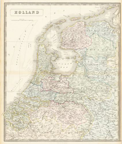
 Holland
 Lithograph, original hand colored in outline. Decorative double page hand colored lithograph antique map, showing...
€95.00

