The following products have been found matching your search "isles": 127
Or did you mean: issues | isle | isla | Isle of Man | islet | british isles | The British Isles | isis
No results were found for the filter!
 Archipel des Indes Orientales, qui comprend les Isles de la Sonde, Moluques et Philippines, tirées des Cartes du...
 Copper engraving, hand colored in outline. Detailed map of the region from Sumatra and Malaca and Southern China to...
€425.00
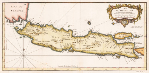
 Idée de L´Isle de Java Tirée des Manuscrits Hellandeis Pour Servir a l`Histoire Generale des Voyages.
 Original antique copper engraving, later hand colored. This beautiful map shows the islands of Java, Pulau Madura,...
€245.00
 Carte des Isles de Java, Sumatra Borneo & a les Détroits de la Sonde Malaca et Banca Golphe de Siam & Par N....
 Copper engraving, hand colored in outline and wash. Published in Prevost d'Exile's Histoire generale des...
€95.00
 Carte des Isles de Java, Sumatra Borneo & a les Détroits de la Sunde Malaca et Banca, GolfAugmentte de Siam &...
 Original antique copper engraving, hand colored in outline and wash. A detailled map focussing on Sumatra, the...
€175.00
 General Carte von Gross Britannien nach den neuesten Hülfsmitteln bearbeitet. in Wien bey Tranquillo Mollo
 Original antique copper engraving, hand colored in outline and wash, when published. Detailled map of the British...
€195.00
 Charte der vereinigten Königreiche Grossbritannien und Irland; Nach Kitchin, Dorret und Beaufort's reducirter...
 Original copper engraving, hand colored in outline when published. Decorative early nineteenth century map of the...
€275.00
 Die Britischen Inseln oder die Vereinigten Königreiche Grossbritanien und Ireland.
 Original steel engraving, hand colored in outline when published. The map is engraved by E. Kratz and was drawn by H....
€145.00
 Pascaart vant Canaal
 Original antique copper engraving, uncolored. Rare and very decorative nautical chart of the British Isles and the...
€1,400.00
 Britische Inseln
 Original lithograph, hand colored in outline when published. This original old map depicts the British Isles with...
€95.00
 Grosbritanien und Irland entworfen von C. F. Weiland. Weimar im Verlage des Geograph. Instituts 1822.
 Copper engraving, hand colored in outline when published. A detailed and interesting map by the German mapmaker Carl...
€295.00
 Insularum Britannicarum Acurata Delineatio et Geographici Conatibus Abrahami Ortelii; Petrus Kaerius Caelavit.
 Original antique copper engraving, decorative hand colored in outline when published. Published in a Latin text...
€645.00
 Ingria et Carelia
 Original copper engraving, hand colored in wash and outline. The decorative map depicts roads, rivers, waterways,...
€2,200.00

