The following products have been found matching your search "laesst": 8
No results were found for the filter!
 Germania Milliaria Germani
 Original antiker Kupferstich in späterem Handkolorit. Diese kleine dekorative Landkarte zeigt Deutschland und Teile...
€145.00
 Kornmarkt Regensburg
 Original Kupferstich gedruckt u. verlegt bei Martin Engelbrecht in Augsburg um 1700-20.395 Darstellung des...
€395.00
 Die Gegend des Rheins von Speyer bis Mayntz nebst der Situation längst der Bergstrasse zwischen dem Rhein und dem...
 Original Kupferstich in zeitgenössischem Grenz- und Flächenkolorit. Die Karte von 2 Platten gedruckt mit...
€850.00
 A map of the West Indies and Middle Continent of America from the latest Observations by John Blair L.L.D. &...
 Copper engraving, uncolored, engraved by Thomas Kitchin. The map shows the West Indies, Florida, the Southern United...
€375.00
 A New Map of Scotland, from the latest Authorities.
 Copper engraving, handcolored in outline and wash when published. Large and very detailed map of Scotland divided up...
€295.00
 C.Theil von Nordschweden und zwar die Laens 23. Iamtland, 24. Westernorrland, 25. Westerbotten nebst 26 u. der...
 Lithograph, original hand color in outline.
€125.00
 West Indies Lesser Antilles or Caribbee 1st Guadeloupe to Trinidad compiled from the last Government surveys
 Original antique steel engraving. Admiralty chart, designed as an aid to navigation at sea. Chart Number 956,...
€550.00
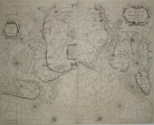
 a. De Texel Stroom en de Gaten van Marsdiep. Inset (c. 24 x 12cm) : Caarte vande Rede en Haven van Medenblick hoemen...
 Two sea-charts on one doublepage. The left one is showing Medenblick, Texel and Wieringen. Additional there is a...
€1,250.00

