The following products have been found matching your search "long": 101
No results were found for the filter!
 Egypt - Published under the Superintendence of the Society for the Diffusion of Useful Knowleage. By G. Long, Prof....
 Steel engraving, hand colored in outline and wash when published. This antique map shows Egypt. In the centre of the...
€30.00
 Der Seeboden an der atlantischen Küste der Vereinigten Staaten von Nordamerika. Nach den Untersuchungen der...
 Lithograph, original color in outline and wash. A highly interesting map of the eastern seaboard depicting the sea...
€40.00
 Der Seeboden aus der atlantischen Küste der Vereinigten Staaten von Nordamerika. Nach den Untersuchungen der...
 Lithograph, original color in outline and wash. A highly interesting map of the eastern seaboard depicting the sea...
€40.00
 Serenissimo Principi Domino AC Domino Friderico Marggravio Brandenburgi Duci Borussiae Silesiae, Magdeburgi,...
 Original antique copper engraving, hand colored in outline and wash when published. Diese antike Landkarte zeigt das...
€375.00
NEW
 Tres llibres de Joan Miró
 Poster produced for the presentation in Osaka, Japan of the book on Miro's work,Joan Miró y Catalunya', along...
€180.00
 Prospectus amoeniss. vallis Oeniponticae una cum antro in altissima et praeruptissima rupe Imp. Maximiliani primi. -...
 Original antiqu copper engraving, uncolored, published in volume V of the townbooks "Civitates Orbis...
€395.00
 Die Erde in zwey Halbkugeln der östlichen und westlichen nach den neuesten Entdeckungen dargestellt.
 Original antique copper engraving, hand colored in outline and wash, when published. A decorative world map by...
€350.00
 Connecticut. Carte Géographique, Statistique et Historique Du Connecticut.
 Copper engraving, hand colored in outline and wash when published. Fine engraved map of Connecticut, showing various...
€240.00
 New York. Carte Géographique, Statistique et Historique Du New-York.
 Copper engraving, hand colored in outline and wash. Fine engraved map of the state of New York showing various...
€250.00
 Carte Particuliere de L´Amerique septentrionale, ou font Compris le Destroit de Davids le des Troit de Hudson,...
 Copper engraving, uncolored as published. This map was published ca.1704 in Pierre Mortier's famous sea-atlas 'Le...
€950.00
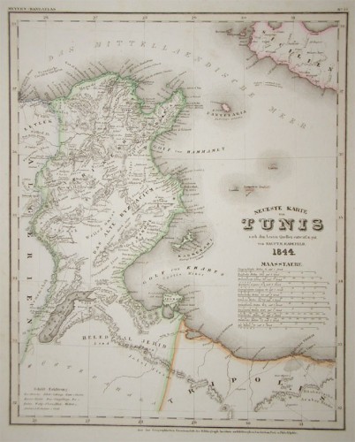
 Neueste Karte von Tunis nach den besten Quellen entworf. und gez. vom Hauptm. Radefeld.
 Steel engraving, in original colors, as published. A detailed map of Tunisia with many place names inland and along...
€80.00
 Pascaert vande Bocht van Benin, Tary Ardra en Rio de Lagos, van Acra tot C. Formosa.
 Original antique copper engraving, uncolored as published. This decorative sea chart shows Benin in West Africa....
€495.00

