Buchon, Jean Alexandre
Connecticut. Carte Géographique, Statistique et Historique Du Connecticut.
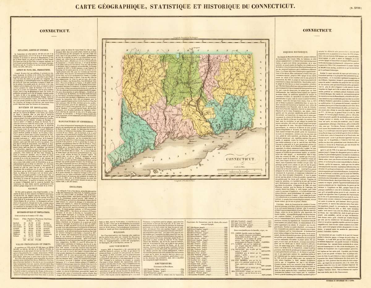
Buchon, Jean Alexandre – Connecticut. Carte Géographique, Statistique et Histori... · Antique Map, Copper Engraving · 455 x 608mm · J. Carez, Paris 1825
Eigenschaften
- Published: J. Carez , Paris
- Published date: 1825
- Technique: Copper engraving / Original color.
- Type: Antique Map, map
- Issue date: 1825
- Category: Connecticut
- Size: 455 by 608mm (18 by 24 inches).
- Stock number: 14019
- Condition: In excellent condition. 455 by 608mm (18 by 24 inches).
Article description
Article description
Copper Engraving, hand-colored in outline by Buchon, Jean Alexandre, published 1825 by J. Carez, Paris. Image size: 455 by 608mm (18 by 24 inches). A detailed map from Buchon's 1825 Atlas géographique, the French edition of Carey & Lea's celebrated American atlas. Jean Alexandre Buchon (1791–1846) was a French historian and geographer who produced the influential Atlas géographique, statistique, historique et chronologique des deux Amériques et des îles adjacentes (1825), published in Paris by J. Carez. This atlas was the French edition of the celebrated Carey & Lea atlas of the United States. Each map was surrounded by letterpress text describing the economic, political, geographical, and historical statistics of the depicted region in French, making it an extraordinary reference work for European readers at the dawn of the Americas' independence era. The maps were engraved in Paris to the highest standards of the day and remain important primary documents for the study of early 19th-century American geography as understood by European scholars. Fine engraved map of Connecticut, showing various rivers, trails, streets, villages and small place names. Connecticut is divided up into its counties in original wash hand color. The map is surrounded by descriptive text on Connecticut, providing information on the climate, the rivers, cities and its history. A nice and decorative map of Connecticut with the adjacenting Long Island Sound. In excellent condition.Buchon, Jean Alexandre – Connecticut. Carte Géographique, Statistique et Histori... · Antique Map, Copper Engraving · 455 x 608mm · J. Carez, Paris 1825
You might also be interested in the following products
 Connecticut
 Lithograph, hand-colored in outline by Mitchell, Samuel Augustus, published 1846 by S. Augustus Mitchell,...
€90.00
Recently viewed products