Petermann, A.
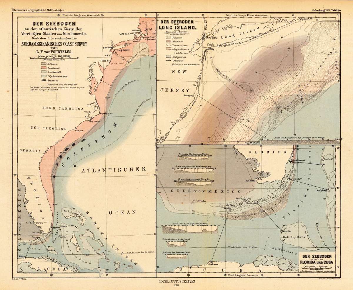
Der Seeboden an der atlantischen Küste der Vereinigten Staaten von Nordamerika. Nach den Untersuchungen der...
Petermann, A. – North America · Lithograph, Printed in Colours · Petermanns Geographische Mitteilungen, Gotha · 1870
Eigenschaften
- Published: Justus Perthes. , Gotha
- Published date: 1870
- Type: Antique Map, map
- Category: Eastern seaboard, North America
- Technique: Lithograph / Original color.
- Issue date: 1870
- Size: 247 by 306mm (9 by 12 inches).
- Stock number: 22475
- Condition: In excellent condition.
Article description
Article description
Original antique lithograph, printed in colours, published by Justus Perthes in Gotha for 'Petermanns Geographische Mitteilungen', 1870. Lithograph, original color in outline and wash. Sheet: 247 by 306mm (9 by 12 inches).. August Heinrich Petermann (1822–1878) was one of the most important German cartographers and geographers of the 19th century. Born in Bleicherode, Saxony, he trained at the Geographische Kunstschule in Potsdam under Heinrich Berghaus — himself a leading student of Alexander von Humboldt. After a formative decade in Edinburgh and London (1845–1854), where he gained broad experience in the commercial and scientific aspects of cartography, Petermann returned to Gotha and joined the Justus Perthes publishing house. In 1855 he founded 'Petermanns Geographische Mitteilungen' (PGM), which swiftly became one of the world's foremost geographical journals — the definitive record of the great age of exploration and discovery. Petermann personally produced over 500 maps and signed 226 articles in PGM, ranging across Africa, the Polar regions, Asia, and the history and practice of cartography. In 1902, the eminent British cartographer J. G. Bartholomew wrote: 'No one has done more than he to advance modern cartography.' His maps are held in major institutions worldwide, including the Library of Congress, the British Library, and the Bibliothèque nationale de France. A highly interesting map of the eastern seaboard depicting the sea bed of the atlantic ocean. Three maps on one sheet: The east coast from Massachusetts to Florida, Long Island and the region between Florida and Cuba. In excellent condition.Petermann, A. – North America · Lithograph, Printed in Colours · Petermanns Geographische Mitteilungen, Gotha · 1870
You might also be interested in the following products
 Amerique...
 Copper engraving, hand colored in outline and wash when published. Fine engraved map of the state of North America...
€480.00
 America...
 Copper engraving, hand colored in wash when published. This map of North America published by G. Tasso in Venice is...
€475.00
 Delaware and...
 Lithograph, color by Johnson & Ward, published 1862 by Johnson & Ward, New York. Image size: 400 by 320mm (15...
€90.00
 Vereinigte...
 Lithograph, hand-colored in outline by Bromme, Traugott, published 1855 by Hoffm.Verlagsbuchhandlung, Stuttgart....
€80.00
Recently viewed products