The following products have been found matching your search "old maps": 233
Or did you mean: maps | map | world map | world maps | MAPS OF THE WORLD | map asia | wall map | Latin map
No results were found for the filter!
 Die Zee Custen van Ruslant, Laplant, Finmarcken, Spitsbergen en Nova Zemla. t'Amsterdam, By Pieter Goos...
 Copper engraving, finely hand colored in outline, when published. Partially heightened in gold. A highly decorative...
€1,650.00
 Pascaerte Van't Westelycke Deel van Oost Indien, Van Cabo de Bona Esperanca, tot C. Comorin. Tot Amsterdam,...
 Copper engraving, finely hand colored in outline, when published. Partially heightened in gold. The map of the...
€3,500.00
 Carte des Isles de Majorque. Minorque et Yvice. Par M. Bellin Ingenieur du Roy et de la Marine. A' Venise Chez...
 Copper engraving, hand colored in outline. This beautiful antique map shows the islands Mallorca, Minorca, Isles...
€490.00
 Wien
Wien Original copper engraving, uncolored when published. Engraving from Frederick de Wit: "Theatrum Praecipuarum...
€1,950.00
 Nouveau Plan Illustré de la ville de Paris ave le systéme complet de ses Fortifications et forts Détachés A Paris...
 Copper engraving, hand colored when published. Fine engraved pictorial city plan of Paris, depicting the...
€375.00
 Granata - Granada
 Original antique old colored copper engraving, published in the townbook "Civitates Orbis Terrarum" by Georg Braun...
€645.00
 Sup. et Inferioris Ducatus Silesiae in suos XVII minores Principatus et Dominia Divisi Nova Tabula in lucem edita a...
 Copper engraving, uncolored as published. Detailed map of upper and lower Silesia by the Dutch cartographers Covens...
€395.00
 Planisphaerium Ptolemaicum sive Machina Orbium Mundi Ex Hypothesi Ptolemaica in Plano Disposita
 Original antique copper engraving, beautiful hand colored in outline and wash when published and heightened in gold....
€3,750.00
 Carte du Chili Méridional, du Rio de la Plata, des Patogons, et du Détroit de Magellan, Ce qui fait l`estremité...
 Copper engraving, hand colored in outline. The map first appeared in Santini's Atlas Universel in 1776-79 in...
€495.00
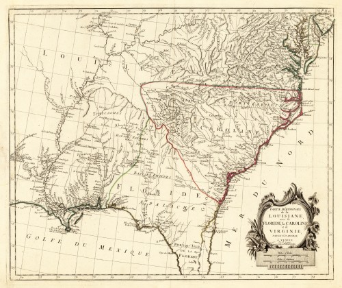
 Partie Méridionale de la Louisiane avec la Floride la Caroline et la Virginie, Par le Sr. D. Anville. A´Venise Par P...
 Copper engraving, hand colored in outline. This antique map shows large parts of Florida, Carolina and Louisiana. In...
€645.00
 Carte du Mexique, et de la Nouvelle Espagne, Contenant la Partie Australe de L`Amérique septentle. Par Mr. D`Anville....
 Copper engraving, hand colored in outline. This map is depicting the southeastern part of the United States with...
€545.00
 Accuratissima Angliae Regni Walliae Principatus Descriptio Distincete divisa in Omnes fuas Provincias et editia per...
 Copper engraving, hand colored in outline when published. A very detailed and rare old map of England and Walles...
€480.00

