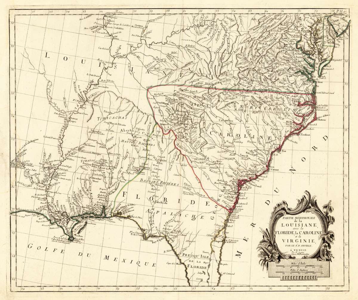
Santini, Francois & Remondini
Partie Méridionale de la Louisiane avec la Floride la Caroline et la Virginie, Par le Sr. D. Anville. A´Venise Par P...
Santini, Francois & Remondini – Partie Méridionale de la Louisiane avec la Floride la C... · Antique Map, Copper Engraving · 493 x 585mm · Jean Baptiste Bour...
€645.00
Prices incl. VAT plus shipping costs
This item is sold. Please contact us if you are searching for this item.
Eigenschaften
- Published: Venice
- Published date: 1784
- Technique: Copper engraving / later hand color
- Issue date: 1784
- Type: map
- Category: Louisiana, Florida, Carolina and Virginia
- Size: 493 by 585mm (19 by 23 inches).
- Stock number: 28039
- Condition: In excellent condition. 493 by 585mm (19 by 23 inches).
Article description
Article description
Copper Engraving, hand-colored in outline by Santini, Francois & Remondini, published 1784 by Jean Baptiste Bourguignon d'Anville, Venice. Image size: 493 by 585mm (19 by 23 inches). Francesco Santini and the Remondini family formed a publishing partnership that produced some of the finest Italian-French cartographic collaborations of the late 18th century. Santini, based in Venice, worked with the celebrated Bassano del Grappa publishing dynasty of Remondini to produce large-format re-engravings of major French maps, including the works of Rigobert Bonne. Their maps of North America — including the Gulf Coast, Louisiana, and Mexico — are among the most detailed Italian maps of the continent produced in the late 18th century and are prized for their size, fine engraving quality, and historical importance. This antique map shows large parts of Florida, Carolina and Louisiana. In the north east of this decorative old map is Virginia, Maryland and New Jersey engraved. A beautiful cartouche and the mileage scale is in the lower right corner. This rare map shows the Eastern seaboard from the Delaware Bay south to Florida and includes also New Orleans and the northern part of the gulf of Mexico. Italy.Santini, Francois & Remondini – Partie Méridionale de la Louisiane avec la Floride la C... · Antique Map, Copper Engraving · 493 x 585mm · Jean Baptiste Bour...
You might also be interested in the following products
 Moluccae Insulae...
 Original antique copper engraving, hand colored in outline and wash when published. A highly decorative map of the...
€550.00
 Pascaert van...
 Original antique copper engraving, uncolored as published. Detailed chart of the Northeastern part of Canada,...
€1,750.00
 Pascaarte vande...
 Copper Engraving, uncolored by van Keulen, Joan, published 1684-1704 by Johannes van Keulen, Amsterdam. Image size:...
€1,100.00
 Guiana sive...
 Copper engraving, hand colored in outline and wash when published. French text edition. Decorative map extending...
€325.00
Recently viewed products