Products from Theunis, Jacobsz & Lootsman, Jacob and Casparus
No results were found for the filter!
 De Custen van Engelant tusschen de twee pointen van Poortlandt en Lezard.
 Fascinating detailed seachart of the south-eastern coast of England showing the coastline from Lizard Point over Plymouth, Torquay, Exeter towards Portland....
€950.00
 Caarte vande Rivier van Bourdeaux tot aen Bayone, ende voorts aen Gataria.
 Copper-engraving, uncolored when published. Detailed sea chart of the area Bordeaux - Bayonne - San Sebastian in South West France and the neighbouring...
€700.00
 De Zee-Custen van Bretaigne, van Heysandt totaen Boelyn. ´t Amsterdam; By Iacob Theunisz, optwater in de Lootsman.
 Copper-engraving, uncolored when published. Detailed sea chart showing the coasts of the Bretagne from Brest towards Vannes with the Island Boelin. Ornated...
€850.00
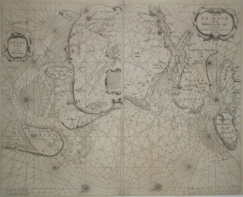
 a. De Texel Stroom en de Gaten van Marsdiep. Inset (c. 24 x 12cm) : Caarte vande Rede en Haven van Medenblick hoemen...
 Two sea-charts on one doublepage. The left one is showing Medenblick, Texel and Wieringen. Additional there is a small inset of Medenblick and Enckhuysen. On...
€1,250.00
 Pascaerte van Groen-Landt, Yslandt, Straet Davids en Ian Mayen eylandt; hoemen de selvrige van Hilandt en de Noort...
 Rare seachart by Jacobsz Theunis of the North Atlantic, showing prominent Greenland, Iceland and parts of the North American continent. The map is decorated...
€1,450.00
 De Custen van Denemarcken, en Sweden, van Valsterbon tot Schenckenes, als mede de custen van Pomeren van 't...
 Detailled seachart of a part of the Baltic Sea with the Southern Swedish coast from Schoenen towards Calmer with the island of Oeland. As well the islands...
€1,450.00
 De Cust van Andaluzia, En Algarve, van Capo de Spichel tot aen het Clif.
 Detailled handcoloured sea-chart showing the Portugese coastline from Setubal S. Vves along the Algarve towards Palos in the South. Villa Nova, Faro, Tavilla...
€850.00
Recently viewed products

