Johnson & Ward
Illinois
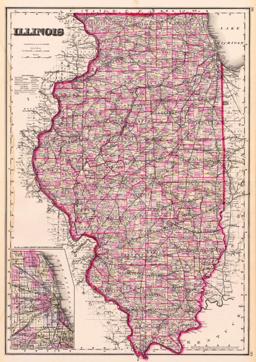
Eigenschaften
- Published: O.W. Gray & Son , Philadelphia
- Published date: 1884
- Type: Antique Map, map
- Technique: Lithograph / Original color.
- Issue date: 1884
- Category: Illinois
- Size: 593 by 418mm (23¼ by 16½ inches).
- Stock number: 20583
- Condition: In very good to excellent condition. Water stain in the middle of the right border.
Article description
Article description
Lithograph, original hand colored in outline and wash.You might also be interested in the following products
 Johnson's...
 Lithograph, original color in outline and wash. Detailed map which shows Illinois. The map is equipped with many...
€50.00

Recently viewed products