Johnson & Ward
Johnson's Illinois by Johnson & Browning.
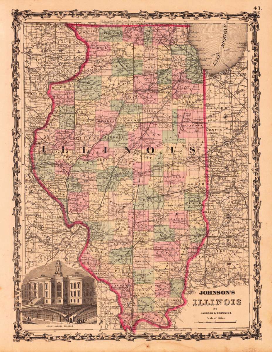
Johnson & Ward – Johnson's Illinois by Johnson & Browning · Antique Map, Lithograph · 420 x 314mm · New York 1868
Eigenschaften
- Published: New York
- Published date: 1868
- Type: Antique Map, map
- Technique: Lithograph / Original color.
- Issue date: 1868
- Category: Illinois
- Size: 420 by 314mm (16 by 12 inches).
- Stock number: 20586
- Condition: In very good condition. 420 by 314mm (16 by 12 inches).
Article description
Article description
Lithograph, original color in outline by Johnson & Ward, published 1868 by New York. Image size: 420 by 314mm (16 by 12 inches). From Johnson's New Illustrated Family Atlas — the leading American atlas of the Civil War era. A.J. Johnson (Alvin Jewett Johnson, 1827–1884) was a New York publisher who created one of the most popular American atlas series of the mid-19th century. Having acquired the plates from Joseph H. Colton in 1860, Johnson produced Johnson's New Illustrated Family Atlas in many editions, partnering first with Browning and then with Benjamin P. Ward (Johnson & Ward, 1863–1866). The Family Atlas went through numerous editions during and after the Civil War, incorporating the latest geographic, railroad, and statistical information. Johnson's maps were engraved on steel with the finest detail available and are distinguished by their vivid hand-applied outline coloring. They are today among the most recognizable and collectible American antique maps of the 19th century. Detailed map which shows Illinois. The map is equipped with many towns, place names, rivers, etc. In the lower left corner we find a print of the Court-House in Chicago. In very good condition.Johnson & Ward – Johnson's Illinois by Johnson & Browning · Antique Map, Lithograph · 420 x 314mm · New York 1868
You might also be interested in the following products
 Illinois
 Lithograph, hand-colored in outline by Johnson & Ward, published 1884 by O.W. Gray & Son, Philadelphia. Image...
€100.00
 Illinois, Indiana...
 Lithograph, original color in outline by Smith, J. Calvin, published 1855-60 by Theodor Fischer, Kassel. Image size:...
€314.00
Recently viewed products