Vandermaelen, Phillippe Marie
Amér. Sep. Partie de la Nouvelle Hanovre. No. 51.
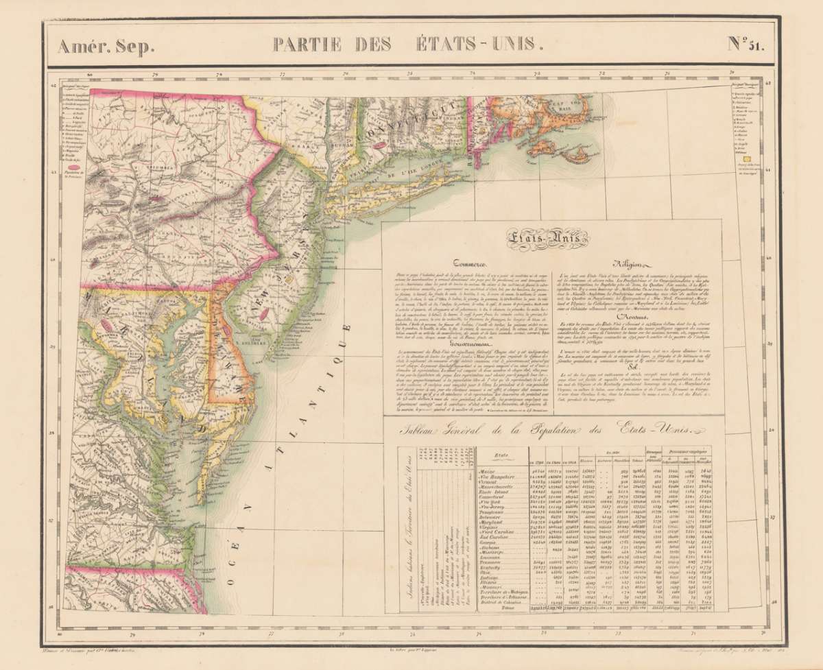
Vandermaelen, Phillippe Marie – Amér. Sep. Partie de la Nouvelle Hanovre. No. 51 · Antique Map, Lithograph · 483 x 565mm · Brussels 1827
Eigenschaften
- Published: Brussels
- Published date: 1827
- Type: Antique Map, map
- Technique: Lithograph / Original color.
- Category: Eastern United States
- Issue date: 1827
- Size: 483 by 565mm (19 by 22 inches).
- Stock number: 22131
- Condition: Published plano without a centre fold. In excellent condition. 483 by 565mm (19 by 22 inches).
Article description
Article description
Lithograph, hand-colored in outline by Vandermaelen, Phillippe Marie, published 1827 by Brussels. Image size: 483 by 565mm (19 by 22 inches). A rare example from Vandermaelen's landmark Atlas universel — the first lithographic world atlas. Philippe Marie Guillaume Vandermaelen (1795–1869) was a pioneering Flemish cartographer and geographer, often called the 'Mercator of young Belgium'. Working from Brussels, he produced the groundbreaking Atlas universel (1825–1827), the first world atlas printed by lithography and the first to depict the entire globe at a single uniform scale. The atlas comprised six volumes with approximately 390 maps, representing a revolution in cartographic publishing. In 1830 Vandermaelen founded the Établissement géographique de Bruxelles, which housed Belgium's first lithographic press dedicated to cartography alongside a public library and ethnographic museum. His North American maps from the Atlas universel are prized by collectors for their accuracy, delicate lithographic detail, and their historic role as the first such images of the continent produced by the lithographic process. A detailed antique map of the Eastern sea board from Cape Code in the North East towards Norfolk in Virginia. The map provides highly detailed information on counties, cities, small villages and towns, roads, rivers, lakes, mountains, Indian tribes, forts and other geographical details. It shows parts of Connecticut, Pennsylvania, New Jersey, Maryland and Virginia. In excellent condition.Vandermaelen, Phillippe Marie – Amér. Sep. Partie de la Nouvelle Hanovre. No. 51 · Antique Map, Lithograph · 483 x 565mm · Brussels 1827
You might also be interested in the following products
 Boston with...
 Steel Engraving, hand-colored in outline by S. D. U. K, published 1842 by Baldwin & Cradock, London. Image size:...
€295.00
 Amèr. Sep. Partie...
 Lithograph, hand-colored in outline by Vandermaelen, Phillippe Marie, published 1827 by Brussels. Image size: 502 by...
€195.00
Recently viewed products