Drayton, J.
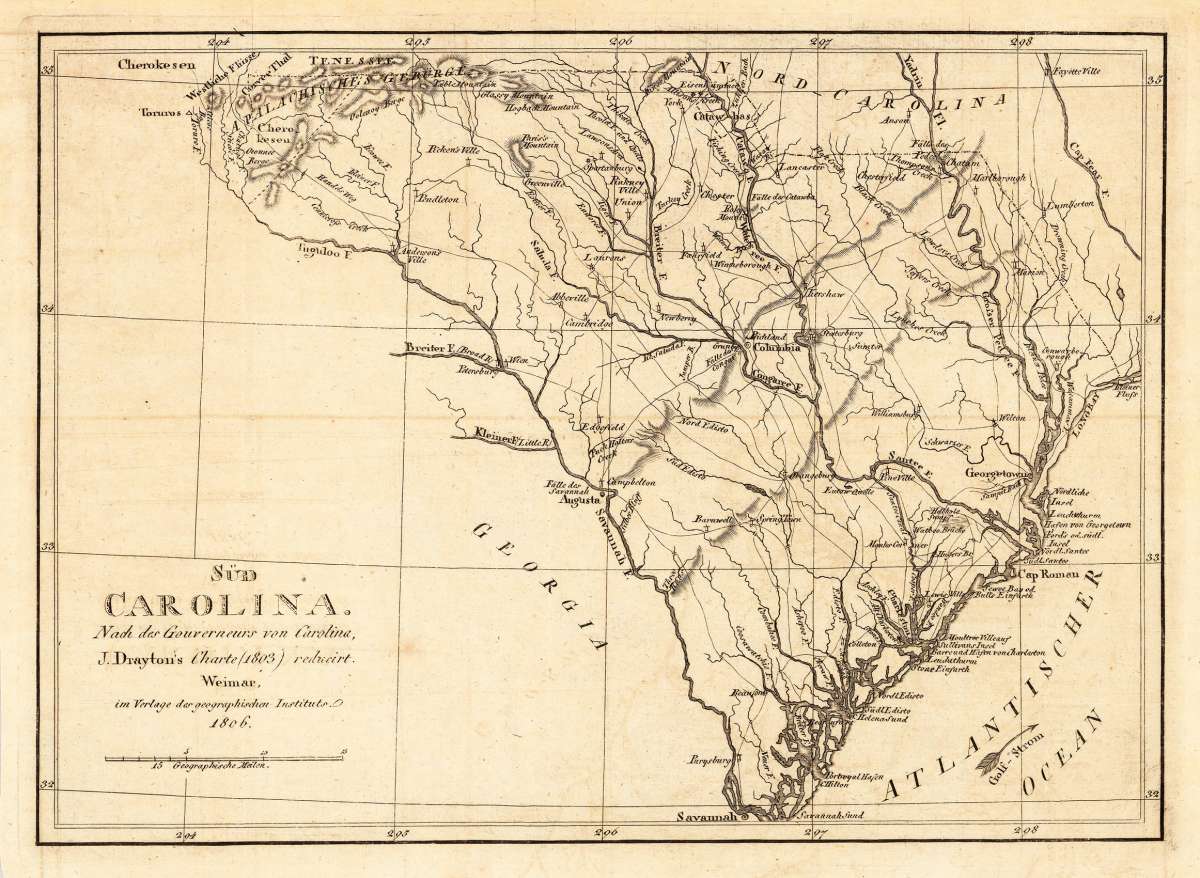
Süd Carolina. Nach des Gouverneurs von Carolina, J. Drayton´s Charte (1803) reduciert.
Drayton, J. – Süd Carolina. Nach des Gouverneurs von Carolina, J. Dra... · Antique Map, Copper Engraving · 214 x 298mm · Geographisches Institut, Weimar 1806
Eigenschaften
- Published: Geographisches Institut , Weimar
- Published date: 1806
- Type: Antique Map, map
- Technique: Copper engraving / Uncolored
- Category: Carolina
- Issue date: 1806
- Size: 214 by 298mm (8 by 11 inches).
- Stock number: 19716
- Condition: In excellent condition. The map was originally published folded, so that the old folds are still slightly visible.
Article description
Article description
Copper Engraving, uncolored by Drayton, J, published 1806 by Geographisches Institut, Weimar. Image size: 214 by 298mm (8 by 11 inches). John Drayton (1766–1822) was the Governor of South Carolina (1800–1802 and 1808–1810) and a prominent American statesman and author. He commissioned a detailed survey of South Carolina that formed the basis for accurate cartographic representations of the state in the early 19th century. His cartographic contribution was published in European editions of the period, offering European audiences a detailed view of one of America's most important coastal and plantation states. This interesting antique map shows South Carolina and its cartographic source is based on Governor Drayton's map of South Carolina of 1803. It is published 1806 at the famous German publishing house 'Geographisches Institute' in Weimar. The map provides lots of details with many place names, routes or streets, rivers, mountains, etc. The map reaches from the Appalachia mountains towards Savannah and from Georgetown towards Long Bay and the Cape fear river. In excellent condition. The map was originally published folded, so that the old folds are still slightly visible.Drayton, J. – Süd Carolina. Nach des Gouverneurs von Carolina, J. Dra... · Antique Map, Copper Engraving · 214 x 298mm · Geographisches Institut, Weimar 1806
You might also be interested in the following products
 Caroline...
 Copper Engraving, hand-colored in outline by Buchon, Jean Alexandre, published 1825 by Carez, Paris. Image size: 440...
€346.00
 Gray's New...
 Lithograph, original color in outline by Gray, Frank, published 1884 by O.W. Gray & Son, Philadelphia. Image...
€70.00
 Die Einwohner der...
 Copper Engraving, color by Mallet, Allain Manesson, published 1719 by Frankfurt. Image size: 150 by 110mm (6 by 4...
€73.00
 Carte...
 Copper Engraving, hand-colored in outline by Buchon, Jean Alexandre, published 1825 by J. Carez, Paris. Image size:...
€245.00
Recently viewed products