Johnson & Ward
Johnson's Georgia and Alabama
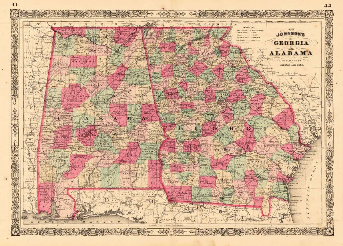
Johnson & Ward – Johnson's Georgia and Alabama · Antique Map, Lithograph · 395 x 560mm · New York 1863
Eigenschaften
- Published: New York
- Published date: 1863
- Type: Antique Map, map
- Technique: Lithograph / Original color.
- Category: Georgia
- Issue date: 1863
- Size: 395 by 560mm (15 by 22 inches).
- Stock number: 20532
- Condition: In very good to excellent condition. Two minor brown spots, one within the image of the map. 395 by 560mm (15 by 22 inches).
Article description
Article description
Lithograph, hand-colored in outline by Johnson & Ward, published 1863 by New York. Image size: 395 by 560mm (15 by 22 inches). From Johnson's New Illustrated Family Atlas — the leading American atlas of the Civil War era. A.J. Johnson (Alvin Jewett Johnson, 1827–1884) was a New York publisher who created one of the most popular American atlas series of the mid-19th century. Having acquired the plates from Joseph H. Colton in 1860, Johnson produced Johnson's New Illustrated Family Atlas in many editions, partnering first with Browning and then with Benjamin P. Ward (Johnson & Ward, 1863–1866). The Family Atlas went through numerous editions during and after the Civil War, incorporating the latest geographic, railroad, and statistical information. Johnson's maps were engraved on steel with the finest detail available and are distinguished by their vivid hand-applied outline coloring. They are today among the most recognizable and collectible American antique maps of the 19th century. This antique map shows the southern states Georgia and Alabama. Inside the map are many place names, rivers, etc. Detailed map of Georgia and Alabama, the two southern states divided up into counties in fine hand color. In very good to excellent condition. Two minor brown spots, one within the image of the map.Johnson & Ward – Johnson's Georgia and Alabama · Antique Map, Lithograph · 395 x 560mm · New York 1863
You might also be interested in the following products
 Johnson's Georgia...
 Lithograph, hand-colored in outline by Johnson & Browning, published 1859 by New York. Image size: 395 by 560mm...
€65.00
 Gray's New...
 Lithograph, original color in outline by Gray, Frank, published 1884 by O.W. Gray & Son, Philadelphia. Image...
€70.00
 Amér.Sep....
 Lithograph, hand-colored in outline by Vandermaelen, Phillippe Marie, published 1825 by Brussels. Image size: 463 by...
€177.00
 L'Ancien et...
 Copper Engraving, uncolored by Bonne, Rigobert, published 1787 by M. Bonne, Paris. Image size: 346 by 235mm (13 by 9...
€195.00
Recently viewed products