Philip, George & Son
United States Sheet II. Eastern States
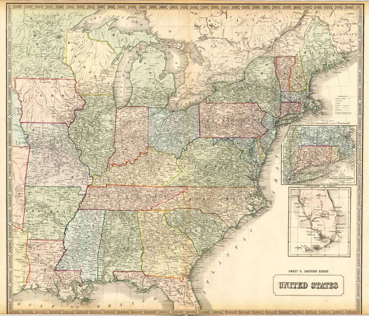
Philip, George & Son – United States Sheet II. Eastern States · Antique Map, Lithograph · 530 x 610mm · Liverpool. Philip & Son 1852
Eigenschaften
- Published: Liverpool. Philip & Son
- Published date: 1852
- Type: Antique Map, map
- Technique: Lithograph / Original color.
- Category: Eastern United States
- Issue date: 1852
- Size: 530 by 610mm (20 by 24 inches).
- Stock number: 17022
- Condition: A very good to excellent example, printed on the full sheet as published, however the lower margin slightly narrow (as published). Just cut on the engraved border line. 530 by 610mm (20 by 24 inches).
Article description
Article description
Lithograph, hand-colored in outline by Philip, George & Son, published 1852 by Liverpool. Philip & Son. Image size: 530 by 610mm (20 by 24 inches). George Philip & Son was a leading British geographical publisher founded in Liverpool and later based in London, producing atlases, educational maps, and globes throughout the 19th and early 20th centuries. Their mid-19th-century maps of North America combined careful British survey traditions with the latest American geographical data, offering a high-quality reference for British readers at a time of intense interest in the expanding United States and British colonial territories in Canada. Large double page hand colored antique map, showing decorative in a large scale the Eastern United States around 1852, additional ornated with two inset maps with a map of New York, Boston & Albany and the other one with the peninsula of Southern Florida. The map provides detailed information on place names, streets, trails, rivers and political borders. A very good to excellent example, printed on the full sheet as published, however the lower margin slightly narrow (as published). Just cut on the engraved border line.Philip, George & Son – United States Sheet II. Eastern States · Antique Map, Lithograph · 530 x 610mm · Liverpool. Philip & Son 1852
You might also be interested in the following products
 Vereinigte...
 Lithograph, color by Flemming, Carl, published 1865 by Glogau, Flemming. Image size: 335 by 410mm (13 by 16...
€145.00
 Vereinigte...
 Copper Engraving, hand-colored in outline by Mollo, Tranquillo, published 1807 by Mollo, Vienna. Image size: 320 by...
€345.00
![Antique Special-Karte der Vereinigten Staaten von Nordamerika. [folded maps in cardboard cover]](https://bergbook.com/media/image/cd/c6/1d/20600_500x500@2x.jpg "Special-Karte der") Special-Karte der...
Special-Karte der... Lithograph, color by Smith, J. Calvin, published 1845 by Theodor Fischer, Kassel. Image size: 1440 by 1840mm (56 by...
€4,200.00
 Ètats-Unis D...
 Copper Engraving, hand-colored in outline by Buchon, Jean Alexandre, published 1825 by J. Carez, Paris. Image size:...
€480.00
Recently viewed products