Liesganig, Josef
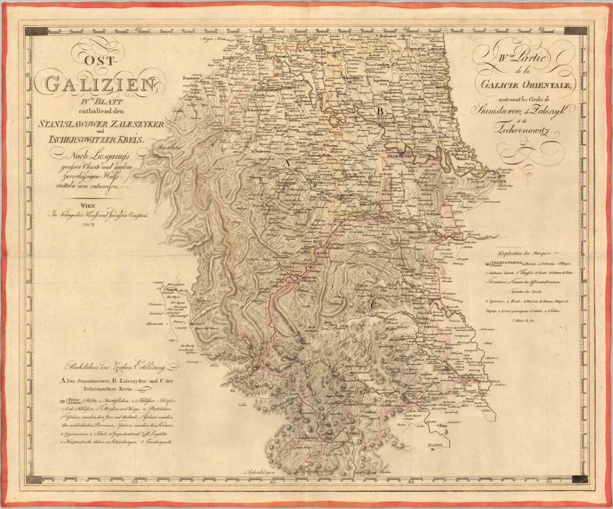
Ost Galizien IVtes Blatt enthaltend den Stanislawower, Zaleszyker und Tschernowitzer Kreis. Nach Liesganig's...
€325.00
Prices incl. VAT plus shipping costs
This item is sold. Please contact us if you are searching for this item.
Eigenschaften
- Published: Kunst & Industrie Comptoir. , Vienna
- Published date: 1803
- Technique: Copper engraving / Original color.
- Type: Antique Map
- Issue date: 1803
- Category: Eastern Galizia (Stanislawow - Zaleszyk - Tschernowitz)
- Size: 472 by 577mm (18 by 22 inches).
- Stock number: 24150
- Condition: The map is mounted on publisher's linen and was folded twice. The old folds are minor visible. In very good to excellent condition.
Article description
Article description
Original copper engraving, hand colored in outline when published. Decorative early nineteenth century map of eastern Galizia engraved after the cartographic sources by J. Liesganig. This is an extremely detailed map of eastern Galizia, showing the circles of Stanislawow, Zaleszyk and Tschernowitz. The map itself provides a lot of information, many small place names are engraved, rivers and woods are shown as well. The map shows also trails and streets, borders, schools and mines. With two explanations in German and French language.
You might also be interested in the following products
 Tabula Asiae II...
 Fine copper-engraved map, printed into the full text page, published in Geografia ... Universale de la Terra , which...
€145.00
 Tartariae Imperium
 Fine copper-engraved map, printed into the full text page, published in 'Geografia ... Universale de la...
€509.00
 Von den Ländern...
 Woodcut published 1628 in the Cosmographia by Sebastian Münster. Early woodcut map published in the 1628 edition...
€95.00
 Dwina Fluuius.
 Original antique copper engraving, hand colored in outline and wash when published. The map is divided into three...
€300.00
Recently viewed products