Weigel, Christoph
Gallia cum Provinciis infertis et adfitis. curante accuratius Christoph Weigelio Noribergae.
Christoph Weigel – Gallia cum Provinciis infertis et adfitis. curante accura... · Original Antique Copper Engraving, Hand Coloured · Chr. Weigel. · Nürnberg...
Eigenschaften
- Published: Chr. Weigel. , Nürnberg
- Published date: 1719
- Technique: Copper engraving / Original color.
- Type: Antique Map, map
- Issue date: 1719
- Category: France
- Size: 277 by 343mm (11 by 13 inches).
- Stock number: 18559
- Condition: Still in very good condition, small loss of printed surface at the right side (in Switzerland). 277 by 343mm (11 by 13 inches).
Article description
Article description
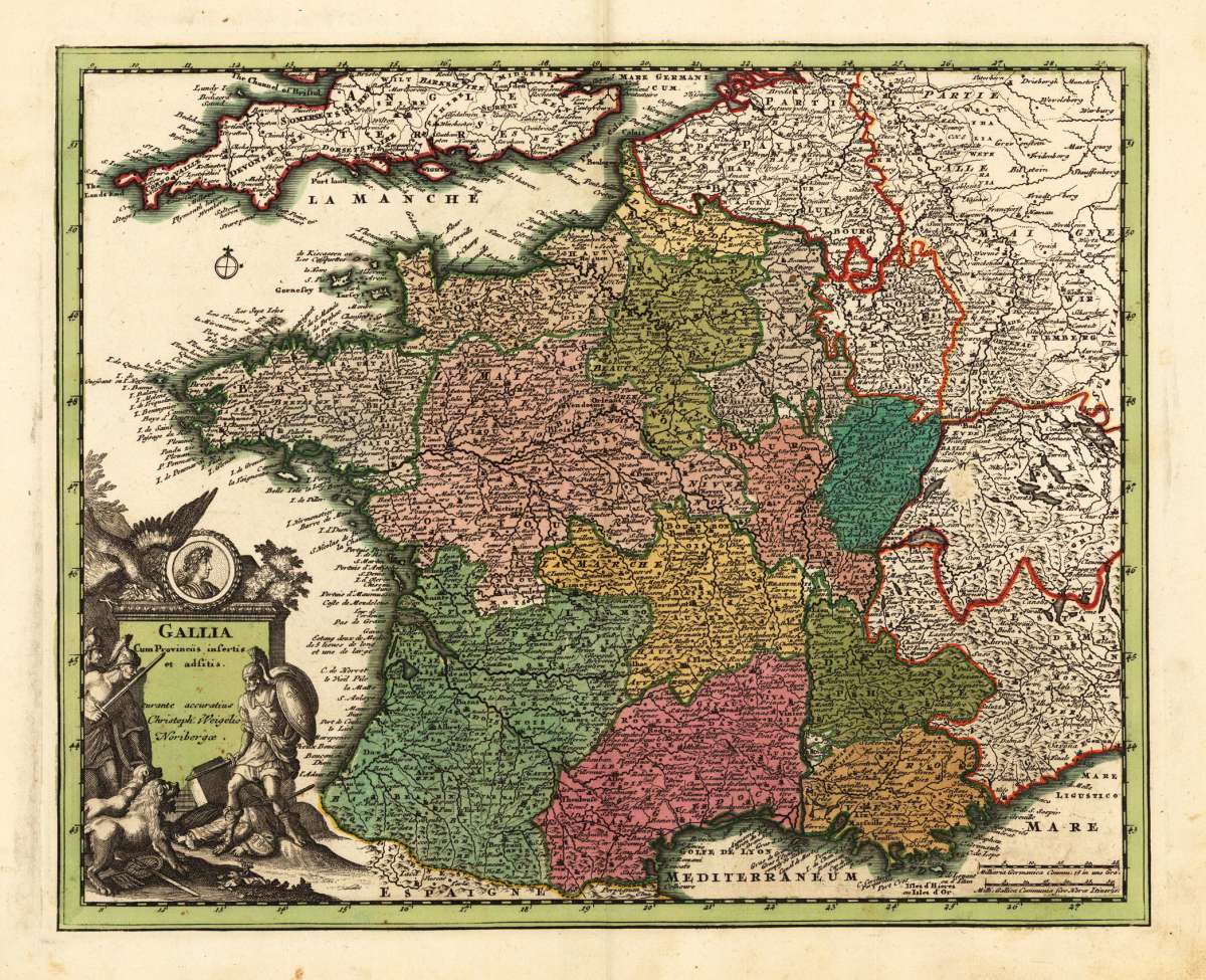
Original antique copper engraving, hand coloured when published, depicting France. Published by Chr. Weigel., Nürnberg, 1719. Sheet: 277 by 343mm (11 by 13 inches).. A fine decorative example of antique cartography by Christoph Weigel, rich in period detail and historical significance. Johann Christoph Weigel (1654–1725), known as Christoph Weigel the Elder, was a Nuremberg-based engraver, publisher, and art dealer who produced a wide variety of prints, including maps, costume plates, and historical illustrations. He published the Atlas Portatilis (1718–1719), a handy atlas of world maps, in Nuremberg. His maps are characterised by neat engraving and attractive hand colour in the Nuremberg cartographic tradition. This highly detailed map shows France divided up into its provinces. The map provides a lot of information on place names, rivers, mountains, etc. The various French provinces are hand colored in period wash and outline colors. In good condition for its age (published 1719). Colours well preserved. Some age-toning and minor imperfections consistent with a document of this antiquity. A condition report is available on request.Christoph Weigel – Gallia cum Provinciis infertis et adfitis. curante accura... · Original Antique Copper Engraving, Hand Coloured · Chr. Weigel. · Nürnberg...
You might also be interested in the following products
 Artesia
 Original antique copper engraving, hand coloured when published, depicting Artois. Published by M. Seutter, Augsburg,...
€145.00
 Artesia. Iacobo...
 Original antique copper engraving, hand coloured when published, depicting Artois. Published in Antwerpen, 1588....
€295.00
 Elsass
 Original antique copper engraving, hand coloured when published, depicting Elsass - Alsatia. Published by Jodocus...
€240.00
 Li contorni di...
 Original antique copper engraving, hand coloured when published, depicting Paris. Published by Antonio Zatta.,...
€180.00
Recently viewed products