Moll, Herman
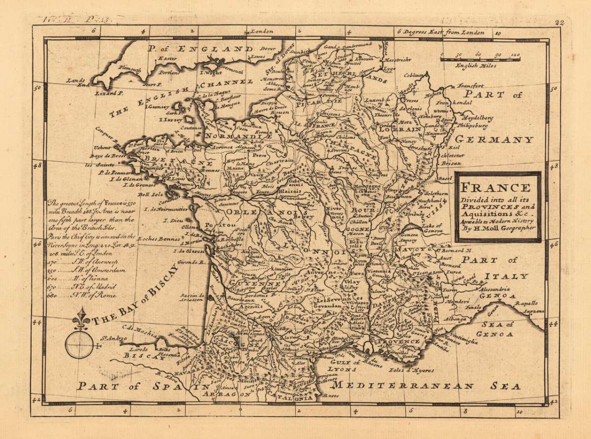
France divided into all its Provinces and Aquisitions & c. Agraeable to Modern History by H. Moll Geographer.
Herman Moll – France divided into all its Provinces and Aquisitions & c... · Original Antique Copper Engraving, Uncoloured · Hermann Moll · London 1736
Eigenschaften
- Published: Hermann Moll , London
- Published date: 1736
- Type: Antique Map, map
- Technique: Copper engraving / Uncolored
- Issue date: 1736
- Category: Acquisitions
- Size: 195 by 261mm (7¾ by 10¼ inches).
- Stock number: 18561
- Condition: In excellent condition. 195 by 261mm (7¾ by 10¼ inches).
Article description
Article description
Original antique copper engraving, hand coloured when published, depicting France divided into all its Provinces and Aquis.... Published by Hermann Moll, London, 1736. Sheet: 195 by 261mm (7¾ by 10¼ inches).. A fine decorative example of antique cartography by Herman Moll, rich in period detail and historical significance. Herman Moll (c.1654–1732) was a Dutch-born cartographer and publisher who settled in London around 1678 and became one of the most prolific English map publishers of his era. He produced atlases, pocket maps, and individual sheets that combined Dutch cartographic traditions with British commercial publishing. His Atlas Minor (1736) provided compact, affordable maps for a wide readership. Moll was acquainted with literary figures including Jonathan Swift and Daniel Defoe. His maps offer lively decorative detail and are valued by collectors for their engaging cartouches and historical content. Published in Hermann Moll's 'Atlas Minor' 1736 in London. The geographer Hermann Moll came originally from the Netherlands and worked in London in the beginning for Moses Pitt. Later he became one of the important map publishers in England. The atlases, which he published were widely well known. He engraved as well maps for other English publishers (John Seller, etc.). In good condition for its age (published 1736). Colours well preserved. Some age-toning and minor imperfections consistent with a document of this antiquity. A condition report is available on request.Herman Moll – France divided into all its Provinces and Aquisitions & c... · Original Antique Copper Engraving, Uncoloured · Hermann Moll · London 1736
You might also be interested in the following products
 Artesia
 Original antique copper engraving, hand coloured when published, depicting Artois. Published by M. Seutter, Augsburg,...
€145.00
 Artesia. Iacobo...
 Original antique copper engraving, hand coloured when published, depicting Artois. Published in Antwerpen, 1588....
€295.00
 Elsass
 Original antique copper engraving, hand coloured when published, depicting Elsass - Alsatia. Published by Jodocus...
€240.00
 Li contorni di...
 Original antique copper engraving, hand coloured when published, depicting Paris. Published by Antonio Zatta.,...
€180.00
Recently viewed products