Weigel, Christoph
Gallia Belgica et Germania utraque cisrhenana superior et inferior excusa - C. Weigelio Norimb. Cum Privil. S. Caes....
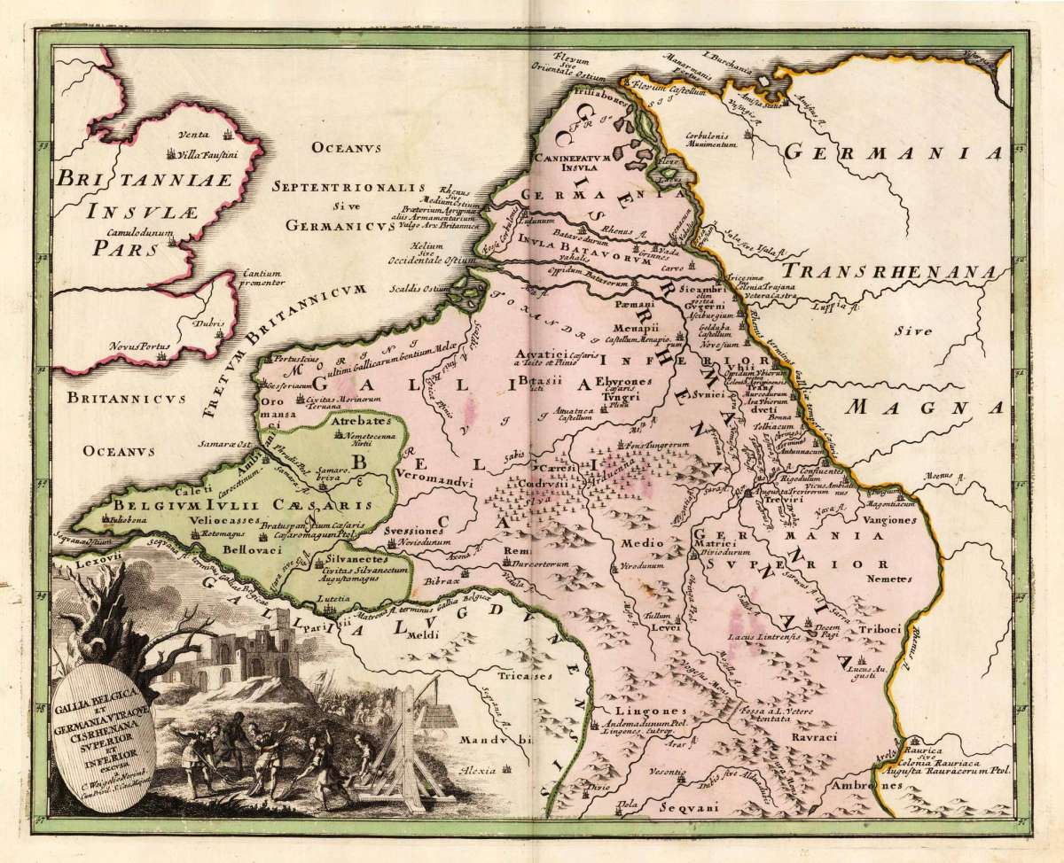
Christoph Weigel – Gallia Belgica et Germania utraque cisrhenana superior et... · Original Antique Copper Engraving, Hand Coloured · Chr. Weigel. · Nürnberg...
Eigenschaften
- Published: Chr. Weigel. , Nürnberg
- Published date: 1719
- Technique: Copper engraving / Original color.
- Type: Antique Map, map
- Issue date: 1719
- Category: France (antique)
- Size: 311 by 387mm (12 by 15 inches).
- Stock number: 27200
- Condition: In excellent condition. 311 by 387mm (12 by 15 inches).
Article description
Article description
Original antique copper engraving, hand coloured when published, depicting France (antique). Published by Chr. Weigel., Nürnberg, 1719. Sheet: 311 by 387mm (12 by 15 inches).. A fine decorative example of antique cartography by Christoph Weigel, rich in period detail and historical significance. Johann Christoph Weigel (1654–1725), known as Christoph Weigel the Elder, was a Nuremberg-based engraver, publisher, and art dealer who produced a wide variety of prints, including maps, costume plates, and historical illustrations. He published the Atlas Portatilis (1718–1719), a handy atlas of world maps, in Nuremberg. His maps are characterised by neat engraving and attractive hand colour in the Nuremberg cartographic tradition. The decorative map shows Belgium, parts of Britain and Germany. The nice engraved title cartouche is engraved in the lower left. In good condition for its age (published 1719). Colours well preserved. Some age-toning and minor imperfections consistent with a document of this antiquity. A condition report is available on request.Christoph Weigel – Gallia Belgica et Germania utraque cisrhenana superior et... · Original Antique Copper Engraving, Hand Coloured · Chr. Weigel. · Nürnberg...
You might also be interested in the following products
 Artesia
 Original antique copper engraving, hand coloured when published, depicting Artois. Published by M. Seutter, Augsburg,...
€145.00
 Artesia. Iacobo...
 Original antique copper engraving, hand coloured when published, depicting Artois. Published in Antwerpen, 1588....
€295.00
 Elsass
 Original antique copper engraving, hand coloured when published, depicting Elsass - Alsatia. Published by Jodocus...
€240.00
 Li contorni di...
 Original antique copper engraving, hand coloured when published, depicting Paris. Published by Antonio Zatta.,...
€180.00
Recently viewed products