Jansonnius, Joan.
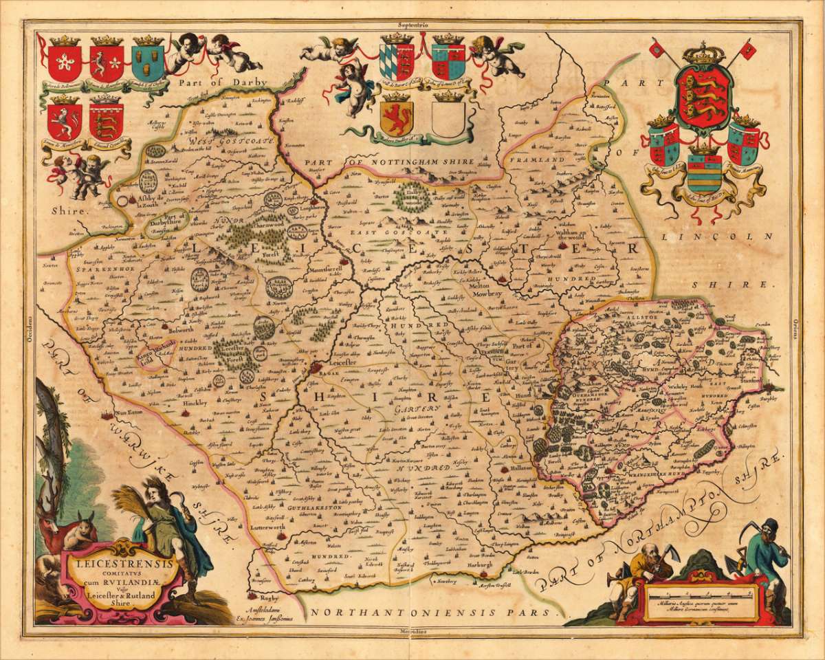
Leicestrensis Comitatus Cum Rutlandiae, vulgo Leicester & Rutland Shire
€295.00
Prices incl. VAT plus shipping costs
This item is sold. Please contact us if you are searching for this item.
Eigenschaften
- Published: J. Janssonius , Amsterdam
- Published date: 1646
- Technique: Copper engraving / Original color.
- Type: Antique Map
- Issue date: 1646-66
- Category: Duchy of Leicester & Rutland Shire
- Size: 440 by 553mm (17¼ by 21¾ inches).
- Bibliography: Koaman Atlanten Neerlandici Vol I /
- Stock number: 17492
- Condition: In very good condition, full margins as published, an older carefully mended split at the lower centrefold.
Article description
Article description
Copper-engraving, handcolored in outline, when published. A fine and highly decorative map of the duchy of Leicester and Rutland Shire. This English county map of Leicester and Rutland is highly decorative with its figurative and allegoric title cartouche, as well the map is ornated with heraldic family coats of arms. On the map itsself are many placenames given, smaller villages or settlements also appear, also rivers, lakes, mountains and woods are also engraved.
Koaman Atlanten Neerlandici Vol I /
You might also be interested in the following products
 Warwicum...
 Original antique copper engraving, uncolored when published. Uncoloured copper engraved map of the South East of...
€195.00
 Provincia di Kent...
 Copper engraving, in contemporary original color in outline. Published in Zatta's 'Atlante Novissimo'....
€125.00
 Provincia di...
 Copper engraving, in contemporary original color in outline. Published in Zatta's "Atlante Novissimo"....
€125.00
 Comitatus...
 Original antique copper engraved map in fine contemporary colors in outline and wash. A fine and highly decorative...
€495.00
Recently viewed products