van Keulen, Joan.
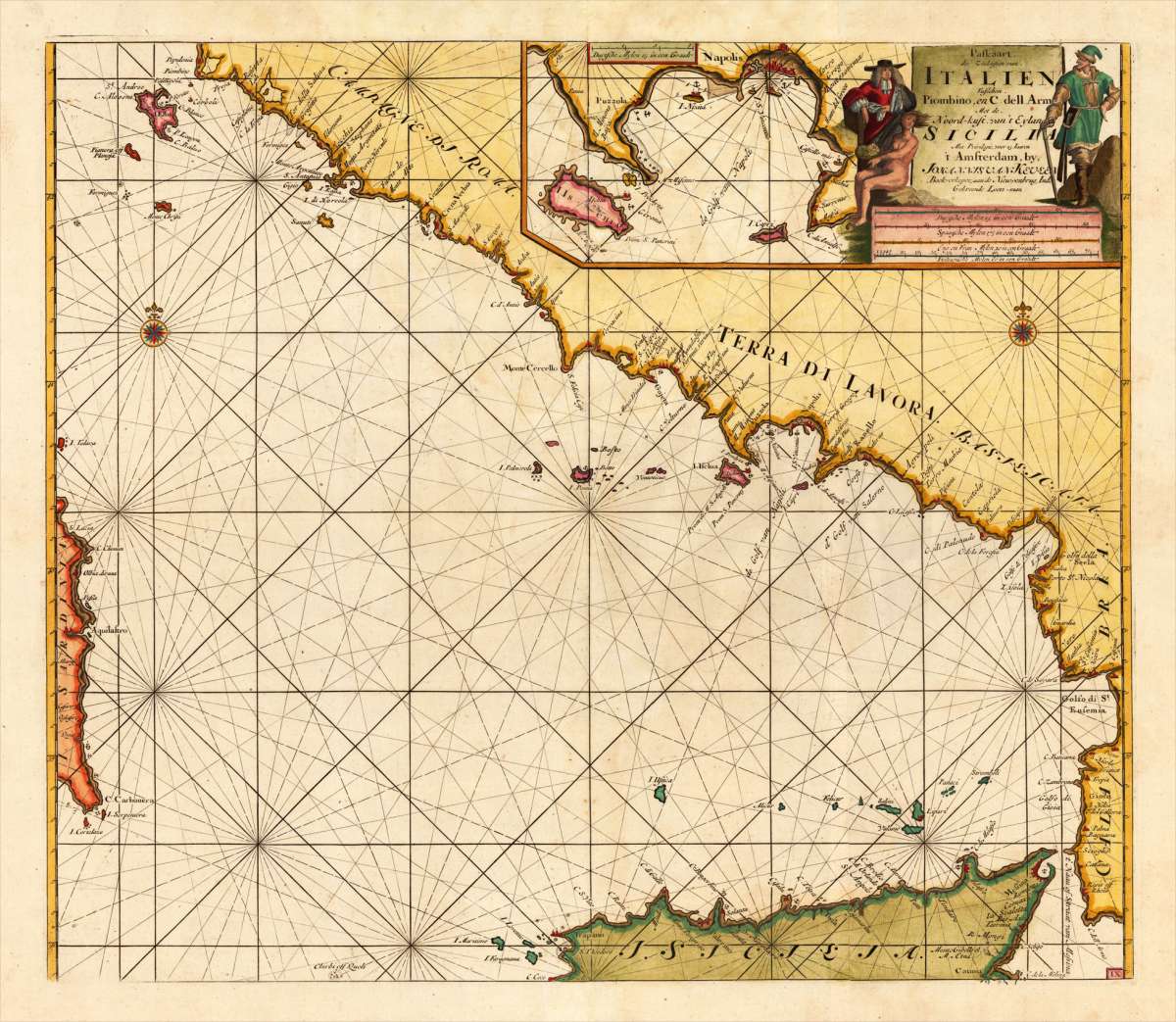
Paskaart der Zeekusten van, Italien Tußchen. Piombino, en C. dell Arme Met de, Noord-kust van`t Eyland Sicilia Met...
Eigenschaften
- Published: Amsterdam
- Published date: 1684
- Technique: Copperengraving/handcolored., Copper engraving / hand colored.
- Issue date: 1684-1704
- Type: map
- Size: 510 by 590mm (20 by 23 inches).
- Stock number: 25159
- Condition: In excellent condition.
Article description
Article description
Original antique copper engraving, finely hand colored in outline and wash, probably later hand color. Detailed chart of the south coast of Italy. Remarkable the highly decorated hand colored title cartouches. T Amsterdam By Johannes Van Keulen Boek en Zee-kaart verkoper aande Nieuwe Brugh in de Gekroonde Loots-man Met Privilegie voor 15 Iaaren. Johannes van Keulen (1654 in Deventer – 1715 in Amsterdam) was a 17th-century Dutch cartographer. He published the influential nautical atlas the Zee-Atlas and the pilot guide Zee-Fakkel (meaning Sea-Torch in English). In 1678 Johannes van Keulen established himself in Amsterdam and in 1680 he obtained a patent from the States of Holland and West Friesland allowing him to print and publish maritime atlases and shipping guides. These were books of maps and descriptions of itineraries, used by helmsmen for safe navigation. The patent was a kind of protection against illegal copying of produced books and charts. This was especially important for the atlases which were made with extensive initial costs. Van Keulen named his firm 'In de Gekroonde Lootsman' ('In the Crowned Pilot'). Soon Van Keulen struck a deal with cartographer Claes Jansz. Vooght. From 1681 onwards the Nieuwe Lichtende Zee-Fakkel appeared, a five-volume atlas for which Vooght compiled the maps[1] and which was illustrated by Jan Luyken. The five volume Zee-Fakkel made Johannes van Keulen famous. The Zee-Fakkel was published in 5 volumes between 1681 and 1684 containing over 130 new charts. (Wikipedia)You might also be interested in the following products
 Gray's New...
 Original antique hand colored lithograph. Detailed map, colored by counties and showing townships, towns, villages,...
€65.00

 Pas-Caart van de...
 Original copper engraving, finely later hand colored in ouline and wash. Remarkable the highly decorated handcolored...
€1,100.00
 Latium. Ex...
 Original antique copper engraving, published 1612 in the famous historical Atlas "Parergon" (Latin...
€495.00
Recently viewed products