Bonne, Rigobert
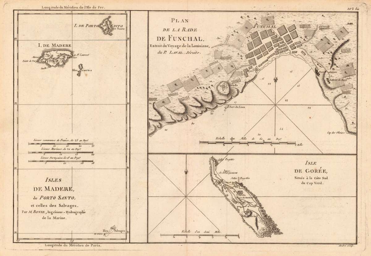
Isles de Madere, de Porto Santo, et celles des Salvages, - Par M. Bonne, Ingénieur-Hydrographe de la Marine. - Plan...
Eigenschaften
- Published: M. Bonne , Paris
- Published date: 1780
- Type: Antique Map, map
- Technique: Copper engraving / Uncolored
- Issue date: 1780-90
- Category: Madeira
- Size: 232 by 343mm (9¼ by 13½ inches).
- Stock number: 18908
- Condition: In excellent condition.
Article description
Article description
Copper engraving, uncolored as published. An antique map, which shows the island Madeira, a plan of Funchal and the island Gorée. The left part of the map shows the island Madeira, next to it the island Porto Santo, both with many place names, mountains, rivers. The map is also equipped with a mileage scale. In the second section of the map is a large plan of Funchal with the port and the surrounding. Rigobert Bonne (1727-1794) was a French cartographer of the late 18th century. He studied in Paris and practiced cartography. He became a skilled cartographer and hydrographer and became a royal hydrographer at the ,Depot de la Marine' in 1773. In 1780 he engraved and published the maps for Abbe Raynal's work ,Atlas de Toutes Les Parties Connues du Globe Terrestre'. He also published many charts for the ,Depot de la Marine', further he engraved the maps for the ,Atlas Encyclopedique' in 1788 together with Nicholas Desmarest.You might also be interested in the following products
 Zahara - Bornos
 Original antique hand colored copper engraving, published in volume V of the town book "Civitates Orbis...
€480.00
 Bornnes - Zahara
 Hand colored copper engraving, published in the town book "Civitates Orbis Terrarum" by Georg Braun and...
€480.00
 Spain and Portugal
 Lithograph, hand colored in outline when published. Large decorative doublepage handcoloured lithograph in outline,...
€120.00
 Hispania Antiqua...
 Copper-engraving, handcolored in outline, when published. Decorative map of Historic Spain. Divided up in three...
€195.00
Recently viewed products