[Anonymous]
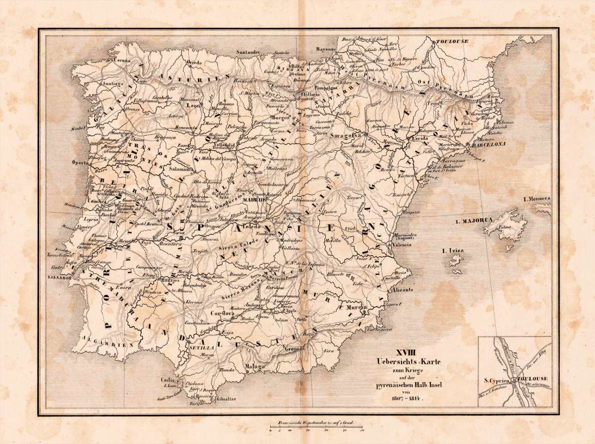
XVIII Uebersichts=Karte zum Kriege auf der pyrenäischen Halb Insel von 1807-1814.
Eigenschaften
- Published: Paris
- Published date: 1830
- Type: Antique Map, map
- Category: Spain
- Technique: Lithgraph, uncolored
- Issue date: 1830-40
- Size: 191 by 257mm (7½ by 10 inches).
- Stock number: 19147
- Condition: In very good condition. 191 by 257mm (7½ by 10 inches).
Article description
Article description
Lithograph, uncolored as published. The map shows an overview to the Napoleonic war on the 'Pyrenean Peninsula' 1807 - 1814. The map provides place names, mountains as well streets and the names of the various Spanish regions.You might also be interested in the following products
 Zahara - Bornos
 Original antique hand colored copper engraving, published in volume V of the town book "Civitates Orbis...
€480.00
 Bornnes - Zahara
 Hand colored copper engraving, published in the town book "Civitates Orbis Terrarum" by Georg Braun and...
€480.00
 Spain and Portugal
 Lithograph, hand colored in outline when published. Large decorative doublepage handcoloured lithograph in outline,...
€120.00
 Hispania Antiqua...
 Copper-engraving, handcolored in outline, when published. Decorative map of Historic Spain. Divided up in three...
€195.00
Recently viewed products