The following products have been found matching your search "carrying": 11
Or did you mean: carried | calling | cartridge | north carolina | carolina | south carolina | caroline | carlina
No results were found for the filter!
 Guinea propia, nec non Nigritiae vel Terrae Nigrorum maxima pars, Geographis hodiernis dicta utraq. Aethiopia...
 Original antique copper engraving, hand colored in outline and wash when published. This antique map shows Guinea...
€445.00
 I. K. (monogramist attributed to Jakob Kallenberg)
 Original woodcut, published 1545 in,Wapen d. heyl. Rom. Reichs Teutscher nation...' by Kölbel. A heraldic series of...
€145.00
 Iudaeae seu Terrae Israelis Tabula geographica: in qua Locorum in Veteri et Novo Testamento celebratißimorum Situs...
 Copper engraving, hand colored in outline when published. A highly decorative map of the Holy Land, which is ornated...
€100.00
 Caroline Meridionale. Carte Géographique, Statistique et Historique De Caroline du South
 Fine engraved map of South Carolina, showing various rivers, trails, streets, villages and small place names. South...
€345.00
 Süd Carolina. Nach des Gouverneurs von Carolina, J. Drayton´s Charte (1803) reduciert.
 Copper engraving, uncolored as published. This interesting antique map shows South Carolina and its cartographic...
€245.00
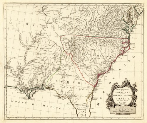
 Partie Méridionale de la Louisiane avec la Floride la Caroline et la Virginie, Par le Sr. D. Anville. A´Venise Par P...
 Copper engraving, hand colored in outline. This antique map shows large parts of Florida, Carolina and Louisiana. In...
€645.00
 North America Sheet XI Parts of North and South Carolina
 Steel engraving, hand colored in outline when published. This antique map shows the East Coast with North and South...
€110.00
 Le Isole Della Sonda Molucche Filippine Caroline E. Marianne
 Original antique engraved map, handcolored in outline when published. Decorative small map of Southeast Asia by an...
€60.00
 Neueste Karte von Süd Carolina mit seinen Canaelen Strassen Dampfschiff Routen und Entfernungen der Hauptpunkte. Nach...
 Steel engraving, hand colored in outline when published.
€205.00
 Carolina By Hermann Moll Geographer Note that y Plantations are marked thus II. A Map of y Island of Bermudos....
 Copper engraving, uncolored as published. The Geographer Hermann Moll worked came originally from the Netherlands...
€545.00
 Eberwurtzel - Carlina
 Original copper engraving, finely hand colored. This finely hand colored emblemata engraving was published 1719 in...
€95.00

