Moll, Herman
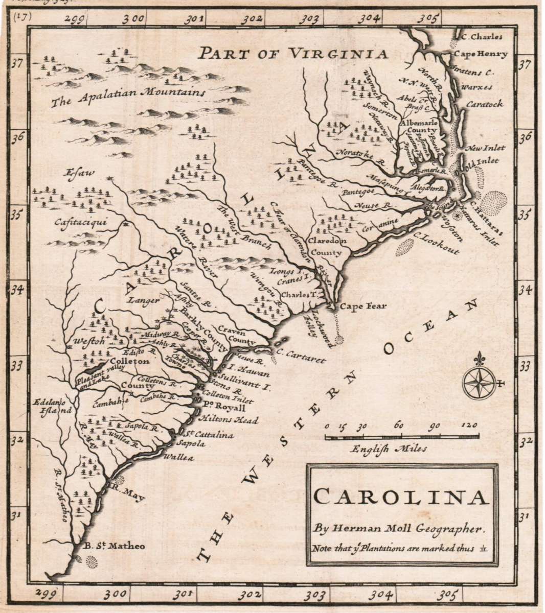
Carolina By Hermann Moll Geographer Note that y Plantations are marked thus II. A Map of y Island of Bermudos....
Moll, Herman – Carolina By Hermann Moll Geographer Note that y Plantat... · Antique Map, Copper Engraving · 176 x 157mm · Th. Bowles and John Bowles, London...
Eigenschaften
- Published: London
- Published date: 1736
- Technique: Copper engraving / Uncolored
- Category: Carolina
- Issue date: 1736
- Type: map
- Size: 176 by 157mm (7 by 6 inches).
- Stock number: 30063
- Condition: In very good condition. A strong impresion.
Article description
Article description
Copper Engraving, uncolored by Moll, Herman, published 1736 by Th. Bowles and John Bowles, London. Image size: 176 by 157mm (7 by 6 inches). By Herman Moll — one of the most important British colonial maps of Carolina. Herman Moll (c.1654–1732) was an influential Dutch-born, London-based cartographer and engraver who became one of the most important map publishers in early 18th-century Britain. His work combining Dutch cartographic precision with British commercial savvy produced some of the most widely distributed maps of the period. His map of Carolina (1736) is a significant document of British colonial cartography, depicting the Province of Carolina with its settlements, rivers, and annotated notes on plantations and Native American territory — reflecting the intense British interest in the economic geography of their American colonies in the early 18th century. The Geographer Hermann Moll worked came originally from the Netherlands and worked in London in the beginning for Moses Pitt. Later he became one of the important map publishers in England. The atlases, which he published were widely well known. He engraved as well maps for other English publishers (John Seller, etc.). In very good condition. A strong impresion.Moll, Herman – Carolina By Hermann Moll Geographer Note that y Plantat... · Antique Map, Copper Engraving · 176 x 157mm · Th. Bowles and John Bowles, London...
You might also be interested in the following products
 Caroline...
 Copper Engraving, hand-colored in outline by Buchon, Jean Alexandre, published 1825 by Carez, Paris. Image size: 440...
€346.00
 Süd Carolina....
 Copper Engraving, uncolored by Drayton, J, published 1806 by Geographisches Institut, Weimar. Image size: 214 by...
€245.00
 Neueste Karte von...
 Steel Engraving, hand-colored in outline by Meyer, Joseph, published 1852 by Meyers, Hildburghausen. Image size: 300...
€205.00
Recently viewed products