The following products have been found matching your search "coast": 103
Or did you mean: coats | coasts | coat | coat of arms Germany | west coast | cost | Const | contrast
No results were found for the filter!
 Carte de L´Isle Celebes ou Macassar. Pour servir a l´Histoire Generale des Voyages.
 Copper engraving, hand colored. A small decorative map of the Island of Celebes with many engraved place names,...
€60.00
 Partie Septentrionale de L´Etat de L' Eglise, contenant les Légations de Ferrare, de Bologne, et de Romagne, par...
 Copper engraving, hand colored in outline. A highly detailed map of the regions Ferrara, Bologna and Romagnola. The...
€445.00
 Carte des Isles de Majorque. Minorque et Yvice. Par M. Bellin Ingenieur du Roy et de la Marine. A' Venise Chez...
 Copper engraving, hand colored in outline. This beautiful antique map shows the islands Mallorca, Minorca, Isles...
€490.00
 West Morlandia, Lan Castria, Cestria, Caernarvan, Denbigh, Flint, Merionidh, Montgomery, Sa, Lopia. cum Insulis Mania...
 Original antique copper engraving, uncolored as published. French text edition. Detailed map of the western coast of...
€295.00
 Cornubia, Deuonia, Somersetus, Dorcestria, Wiltonia, Clocestria. An, Cafermarden, Penbrok, Cardigan, Radnor,...
 Original antique copper engraving, uncolored as published. French text edition. Detailed map of the southwestern...
€295.00
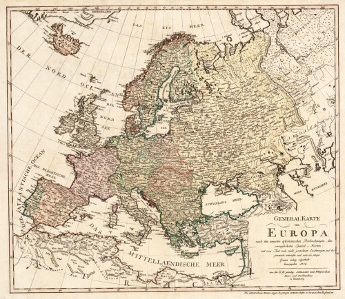
 Generalkarte von Europa, nach den neuesten astronomischen Beobachtungen, den vorzüglichsten Special-Karten und zu...
 Original antique copper engraving, hand colored in outline and wash when published. An interesting and detailed map...
€445.00
 Asiae in Tabula Geographica Delinatio admentem Novissimorum eorumg optimorum Geographorum emendata...
 Copper engraving, hand colored in outline and wash when published. A decorative map of Asia by Petrus Schenk...
€1,250.00
 Carte Nouvelle de la Mer Mediterranee où sont Exactement Remarques tous les Ports, Golfes, Rochers, Bancs de Sable...
 Original copper engraving, hand colored in outline and partial heightened in gold in the period, when published in...
€28,000.00
 Africae Propriae Tabula. In qua, Punica regna uides, Tyrios, et Agenoris urbem
 Copper engraving, hand colored in wash and outline, published in a Dutch text edition of J. Jansson's historical...
€445.00
 Charte von Europa neu entworfen von F.L. Güssefeld. Nürnberg zu finden bey C. Weigel u. Schneider 1794.
 Copper engraving, hand colored in outline and wash when published. The map depicts Europe with its neighbouring...
€375.00
 Amerique Meridionale Pour servir á l´Histoire Generale des Voyages.
 Copper engraving, hand colored in wash. Decorative map of South America published ca. 1760 in an atlas by Nicolaus...
€95.00
 North America Index Map to Canada and the United States
 Original antique steel engraving, hand colored in outline when published. This North America map shows the East...
€65.00

