The following products have been found matching your search "instead": 54
No results were found for the filter!
 Regni Mexicani seu Novae Hispaniae Ludovicianae, N. Angliae, Carolinae, Virginiae et Pensylvaniae, nec non Insularum,...
 Original antique copper engraving, hand colored in outline and wash, when published. This famous map of the...
€1,100.00
 Moluccae Insulae Celeberrimae.
 Original antique copper engraving, hand colored in outline and wash when published. A highly decorative map of the...
€550.00
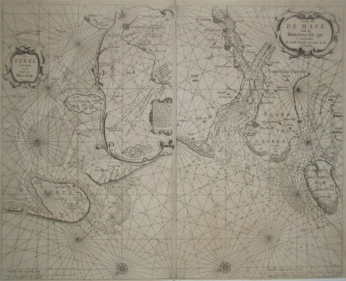
 a. De Texel Stroom en de Gaten van Marsdiep. Inset (c. 24 x 12cm) : Caarte vande Rede en Haven van Medenblick hoemen...
 Two sea-charts on one doublepage. The left one is showing Medenblick, Texel and Wieringen. Additional there is a...
€1,250.00
 Südlicher Theil von Griechenland und die Insel Candia
 Steel engraving, hand colored in outline and wash. This antique map shows the southern part of Greece with the isle...
€150.00
![Banka [lower left corner Antique Banka [lower left corner with inset map: Prefecture de Banka et Billiton]](https://bergbook.com/media/image/6d/f7/a3/32005_500x500.jpg) Banka [lower left corner with inset map: Prefecture de Banka et Billiton]
Banka [lower left corner with inset map: Prefecture de Banka et Billiton] Original manuscript map in colors. This antique manuscript map shows the island of Banka (Bangka, Bangka-Belitung)...
€1,100.00
 Insulae S. Dominicae Tabula Accuratissima.
 Copper engraving handcolored in outline when published. A detailled map covering Haiti (Dominican Republic), the...
€400.00
 Britannicae, Insulae in quibus Albion Seu Britannia Major, et Ivernia seu Britannia Minor juaeta Ptolemaei mentem...
 Copper-engraving, handcolored in outline, when published. Detailed map by the French cartographer Sr. Robert de...
€250.00
 die Insel Stampalla. - Isle De Stampalia.
 Copper-engraving, handcolored in wash and outline. Decorative bird's eye view of the Island of Stampalla with...
€115.00
 Die Insel Lero, Calamo und Lango.
 Copper-engraving, handcolored in wash and outline. This decorative map shows the Island Lero, Calamo and Lango. On...
€110.00
 Die Insel Nisaro und Piscopia. - L' De Nisaro et de Piscopix.
 Copper-engraving, handcolored in wash and outline. This decorative map shows the Island Nisaro and Piscopia. At the...
€110.00
 die Insel Cajenna - ISLES DE CAYENNE
 Copper-engraving, handcolored in wash and outline. Bird's eye view of the Island of Cayenne.
€86.00
 Insulae Danciae in Mari Balthico Sitae, utope Zeelandia, Fiona Langelandia, , Falstria, Fembria Mona repraesentatae...
 Original antique copper engraving in contemporary hand color in wash and outline when published. Fine hand colored...
€295.00

