The following products have been found matching your search "instead": 54
No results were found for the filter!
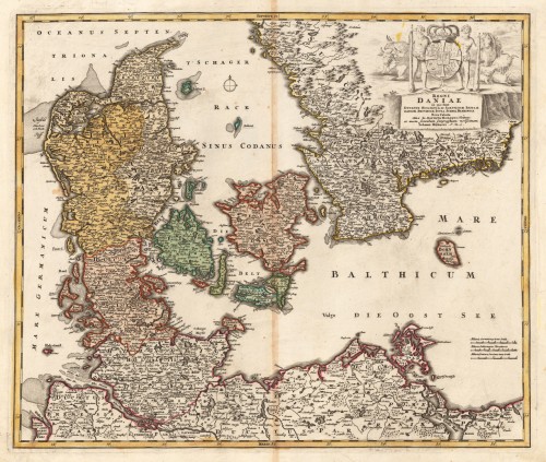
 REGNI DANIAE - in quo funt DUCATUS HOLSATIA ET SLESVICUM INSULAE DANICAE, PROINCIAE IUTIA SCANIA BLEKINGIA. Nova...
 Original antique copper engraving in contemporary hand color in wash and outline when published. A good impression...
€297.00
 REGNI DANIAE - in quo funt DUCATUS HOLSATIA ET SLESVICUM. INSULAE DANICAE PROVINCIAE IUTIA SCANIA BLEKINGIA. Nova...
 Original antique copper engraving in contemporary hand color in wash and outline when published. A good impression...
€275.00
 Particulir Carte des Landes und der Schön Weltberuhmte Gegend umb Paris ... verlegt durch IBH. - Agri Parisiensis...
 Original antique copper engraving in contemporary hand color in wash and outline when published. Decorative map by...
€175.00
 Grundriss von dem Fort Dauphin welches die Franzosen auf der Insel Madagascar erbauet haben zur allgemeinen Historie...
 Copper engraving, uncolored as published. Bird's eye view on the fortress of Fort Dauphin in Madagascar....
€55.00
 Die Diebs Insel. - Isles des Larrons
 Copper-engraving, handcolored in wash and outline. Map of the Larron Islands near the Archipel de St. Lazare, also...
€95.00
 Grundriss von der Bay der Insel St. Vincent, einer von den Eylanden des grünen Vorgebirges im 16 Gr. 50 Min. Norder...
 Copper engraving, uncolored as published. This beautiful map shows the ground plan of the island of St. Vincent....
€50.00
 Grundriss der Insel James oder Jacob auf der Gambra im J. 1732. - Nordostliche Aussicht des St. James Forts. -...
 Copper engraving, uncolored as published. This decorative map shows a ground plan from the island of St. James. The...
€50.00
 XVIII Uebersichts=Karte zum Kriege auf der pyrenäischen Halb Insel von 1807-1814.
 Lithograph, uncolored as published. The map shows an overview to the Napoleonic war on the 'Pyrenean...
€25.00
 Topographische Skizze aus dem Ostarm der Insel Celebes. Aufgenommen im Februar und März 1905 von Dr. J. Wagner
 Lithograph, original color as published.
€55.00
 Die Insel Gorea. - I. Goree
 Copper engraving, hand colored in wash and outline, published in Allain Manesson Mallet's description of the...
€55.00
 Die Insel Biledulgerid. - Biledulglrit en General - Patrie occidentale du Biledulgerid - Patie Orientale du...
 Copper engraving, hand colored in wash and outline, published in Allain Manesson Mallet's description of the world.
€35.00
 Insulae Danciae in Mari Balthico Sitae, utope Zeelandia, Fiona Langelandia, Lalandia, Falstria, Fembria Mona...
 Original antique copper engraving in full contemporary hand color in wash and outline when published. A fine hand...
€295.00

