Robert, Sr.
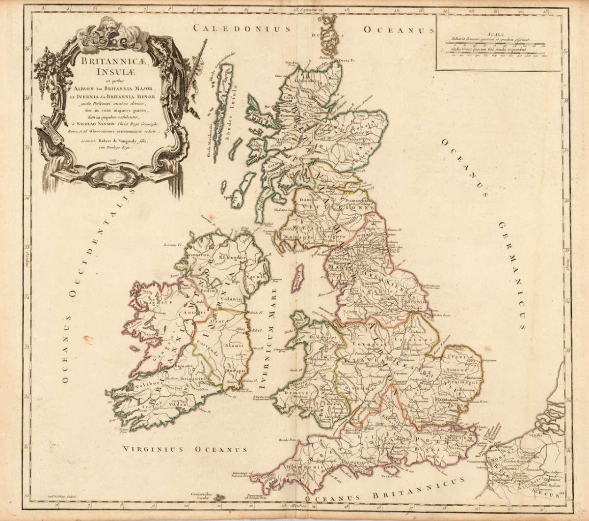
Britannicae, Insulae in quibus Albion Seu Britannia Major, et Ivernia seu Britannia Minor juaeta Ptolemaei mentem...
Eigenschaften
- Published: Sr. Robert , Paris
- Published date: 1752
- Technique: Copper engraving / Original color.
- Type: Antique Map, map
- Category: British Isles
- Issue date: 1752/55.
- Size: 490 by 535mm (19¼ by 21 inches).
- Stock number: 17485
- Condition: In excellent condition. 490 by 535mm (19¼ by 21 inches).
Article description
Article description
Copper-engraving, handcolored in outline, when published. Detailed map by the French cartographer Sr. Robert de Vaugondy. The map shows detailled England, Scotland and Ireland. The map pretty much to date on the newest cartographic sources for this period around 1752-55, engraved after the cartographic sources by Nicolaus Sanson. With many engraved historical place names of cities and villages, streets and routes and mountain chains are shown as well. Ornated with a large decorative allegoric title cartouche in the upper left corner.You might also be interested in the following products
 Li Regni D'...
 Copper engraving, in contemporary original color in outline. Published in Zatta's "Atlante Novissimo"....
€245.00
 Neueste Karte von...
 Steelengraving, handcolored in outline when published. Detailled map of Great Britain and Ireland with many...
€80.00
 General Carte von...
 Original antique copper engraving, hand colored in outline and wash, when published. Detailled map of the British...
€195.00
 Carte des Grandes...
 Copper-engraving, handcolored in outline, when published. Detailed map by the French cartographer Sr. Robert de...
€350.00
Recently viewed products