The following products have been found matching your search "london map": 472
Or did you mean: maps | london | map | world map | world maps | MAPS OF THE WORLD | map asia | wall map
No results were found for the filter!
 Accurater Grundriss u: Gegend der Koenigl: Gross-Brittannischen Haupt und Residentz-Stadt London wie auch Prospecte...
 Original antique copper engraving in full contemporary handcolor in wash and outline when published. A fine antique...
€950.00
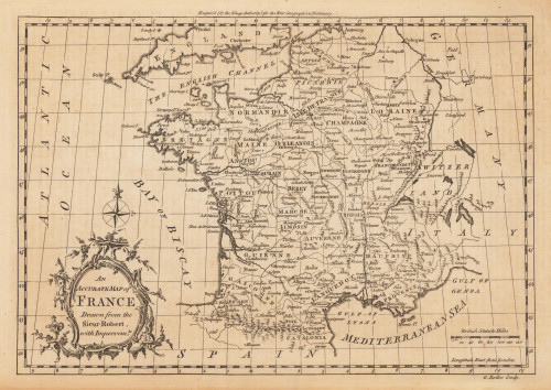
 An Accurate Map of France Drawn from the Sieur Robert, with Improvemts.
 Original antique copper engraving, uncolored. Published in London and engraved for the 'New Geographical...
€80.00
 A Map of y Island of Bermudos. Divided into its Tribes, wth the Castles, Forts, &c. By H.M.
 Copper engraving, uncolored as published. The Geographer Hermann Moll worked came originally from the Netherlands...
€445.00
 North America Index Map to Canada and the United States
 Original antique steel engraving, hand colored in outline when published. This North America map shows the East...
€65.00
 Carolina By Hermann Moll Geographer Note that y Plantations are marked thus II. A Map of y Island of Bermudos....
 Copper engraving, uncolored as published. The Geographer Hermann Moll worked came originally from the Netherlands...
€545.00
 A map of Continent of the East-Indies &c. Explaining what belongs to England, Spain and Holland &c. - By H....
 Copper engraving, decorative handcolored in outline. Small wide and decorative map showing the continent of India...
€375.00
 Italy General Map including Sicily, Malta, Sardinia, Corsica &c. - Published under the Superintendence of the...
 Steel engraving, hand colored in outline when published. This decorative map shows Italy with Sicily, Malta,...
€55.00
 Gray's New Map of Italy
 Original antique hand colored lithograph. Detailed map, colored by counties and showing townships, towns, villages,...
€65.00
 A New and Accurate Map of the Netherlands from the Sieur Roberts Atlas with Improvements.
 Original antique copper engraving, uncolored. Engraved by J. Gibson Original antique map showing the north-western...
€45.00
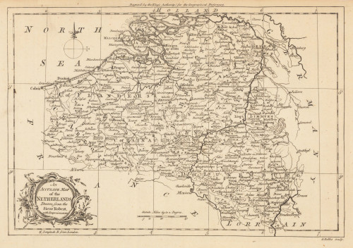
 An Accurate Map of the Netherlands Drawn from the Sieur Robert, with Improvements.
 Original antique copper engraving, uncolored. Original antique map of the Netherlands, published in,the Geographical...
€85.00
 A map of the West Indies and Middle Continent of America from the latest Observations by John Blair L.L.D. &...
 Copper engraving, uncolored, engraved by Thomas Kitchin. The map shows the West Indies, Florida, the Southern United...
€375.00
 A New Map of Scotland, from the latest Authorities.
 Copper engraving, handcolored in outline and wash when published. Large and very detailed map of Scotland divided up...
€295.00

