Antiquariat Reinhold Berg eK
Wahlenstraße 8
D-93047 Regensburg
phone: +49 - 941 52229
cellphone: +49 - 160 9060 6746
mail: [email protected]

The following products have been found matching your search "lowatz": 421

Or did you mean: lower | locate | located | lowitz | lower franconia | lonato | lootz
Close filters
  •  
  •  
    •  
    •  
    •  
    •  
    •  
    •  
    •  
  •  
    •  
  •  
    •  
    •  
    •  
    •  
    •  
  •  
  •  
  •  
  •  
  •  
  •  
  •  
  •  
  •  
  •  
  •  
  •  
  •  
  •  
  •  
  •  
  •  
  •  
  •  
  •  
  •  
  •  
  •  
  •  
  •  
  •  
  •  
  •  
  •  
  •  
  •  
  •  
  •  
  •  
  •  
  •  
  •  
  •  
  •  
  •  
  •  
  •  
  •  
  •  
  •  
  •  
  •  
  •  
  •  
  •  
  •  
  •  
  •  
  •  
  •  
  •  
  •  
  •  
  •  
  •  
  •  
  •  
  •  
  •  
  •  
  •  
  •  
  •  
  •  
  •  
  •  
  •  
  •  
  •  
  •  
  •  
  •  
  •  
  •  
  •  
  •  
  •  
  •  
  •  
  •  
  •  
  •  
  •  
  •  
  •  
  •  
  •  
  •  
  •  
  •  
  •  
  •  
  •  
  •  
  •  
  •  
  •  
  •  
  •  
  •  
  •  
  •  
  •  
  •  
  •  
  •  
  •  
  •  
  •  
  •  
  •  
  •  
  •  
  •  
  •  
  •  
  •  
  •  
  •  
  •  
  •  
from to
  •  
  •  
  •  
  •  
  •  
  •  
  •  
  •  
  •  
  •  
  •  
  •  
  •  
  •  
  •  
  •  
  •  
  •  
  •  
  •  
  •  
  •  
  •  
  •  
  •  
  •  
  •  
  •  
  •  
  •  
  •  
  •  
  •  
  •  
  •  
  •  
  •  
  •  
  •  
  •  
  •  
  •  
  •  
  •  
  •  
  •  
  •  
  •  
  •  
  •  
  •  
  •  
  •  
  •  
  •  
  •  
  •  
  •  
  •  
  •  
  •  
  •  
  •  
  •  
  •  
  •  
  •  
  •  
  •  
  •  
  •  
  •  
  •  
  •  
  •  
  •  
  •  
  •  
  •  
  •  
  •  
  •  
  •  
  •  
  •  
  •  
  •  
  •  
  •  
  •  
  •  
  •  
  •  
  •  
  •  
  •  
  •  
  •  
  •  
  •  
  •  
  •  
  •  
  •  
  •  
  •  
  •  
  •  
  •  
  •  
  •  
  •  
  •  
  •  
  •  
  •  
  •  
  •  
  •  
  •  
  •  
  •  
  •  
  •  
  •  
  •  
  •  
  •  
  •  
  •  
  •  
  •  
  •  
  •  
  •  
  •  
  •  
  •  
  •  
  •  
  •  
  •  
  •  
  •  
  •  
  •  
  •  
  •  
  •  
  •  
  •  
  •  
  •  
  •  
  •  
  •  
  •  
  •  
  •  
  •  
  •  
  •  
  •  
  •  
  •  
  •  
  •  
  •  
  •  
  •  
  •  
  •  
  •  
  •  
  •  
  •  
  •  
  •  
  •  
  •  
  •  
  •  
  •  
  •  
  •  
  •  
  •  
  •  
  •  
  •  
  •  
  •  
  •  
  •  
  •  
  •  
  •  
  •  
  •  
  •  
  •  
  •  
  •  
  •  
  •  
  •  
  •  
  •  
  •  
  •  
  •  
  •  
  •  
  •  
  •  
  •  
  •  
  •  
  •  
  •  
  •  
  •  
  •  
  •  
  •  
  •  
  •  
  •  
  •  
  •  
  •  
  •  
  •  
  •  
  •  
  •  
  •  
  •  
  •  
  •  
  •  
  •  
  •  
  •  
  •  
  •  
  •  
  •  
  •  
  •  
  •  
  •  
  •  
  •  
  •  
  •  
  •  
  •  
  •  
  •  
  •  
  •  
  •  
  •  
  •  
  •  
  •  
  •  
  •  
  •  
  •  
  •  
  •  
  •  
  •  
  •  
  •  
  •  
  •  
  •  
  •  
  •  
  •  
  •  
  •  
  •  
  •  
  •  
  •  
  •  
  •  
  •  
  •  
  •  
  •  
  •  
  •  
  •  
  •  
  •  
  •  
  •  
  •  
  •  
  •  
  •  
  •  
  •  
  •  
  •  
  •  
  •  
  •  
  •  
  •  
  •  
  •  
  •  
  •  
  •  
  •  
  •  
  •  
  •  
  •  
  •  
  •  
  •  
  •  
  •  
  •  
  •  
  •  
  •  
  •  
  •  
  •  
  •  
  •  
  •  
  •  
  •  
  •  
  •  
  •  
  •  
  •  
  •  
  •  
  •  
  •  
  •  
  •  
  •  
  •  
  •  
  •  
  •  
  •  
  •  
  •  
  •  
  •  
  •  
  •  
  •  
  •  
  •  
  •  
  •  
  •  
  •  
  •  
  •  
27 From 36
No results were found for the filter!
Antique Pyramiden von Gizeh bei Sonnenuntergang Pyramiden von Gizeh bei Sonnenuntergang
Perlberg, Friedrich, 1896
Pencil, watercolour and bodycolour on paper. The watercolor depicts the Pyramids of Giza at sunset, in the...
€9,800.00
Antique Neueste Karte von Pennsylvania mit seinen Canaelen, Eisenbahnen & c. Nach den besten Quellen bearbeitet. 1845. Neueste Karte von Pennsylvania mit seinen Canaelen, Eisenbahnen & c. Nach den besten Quellen bearbeitet. 1845.
Meyer, Joseph, 1845
Steel engraving, hand colored in outline and wash when published. Detailed map of the state of Pennsylvania. Inside...
€65.00
Antique Typus Aetiologicus II. Sistens unu obtutu Ductum totius itineris Xenophontaei et Stathmorum Particorum Isodori Characeni, juncta descriptione Ponti Euxini juxta Arrianum, litoris Persici et Peripli Nearchi juxta eundem Arrianum et Marcianum Heracleotam... grad 37 1/2 Latid. Typus Aetiologicus II. Sistens unu obtutu Ductum totius itineris Xenophontaei et Stathmorum Particorum Isodori...
Hase, Johann Matthias, 1739
Original copper engraving, hand colored in outline when published. An unusual rare historical map of Persia with the...
€425.00
Antique Gallia Gallia
[Anonymous], 1755
Original copper engraving, hand colored in outline and wash when published. An unusual small map of France not...
€30.00
Antique Provinz Posen Provinz Posen
Flemming, Carl, 1844
Lithograph, original color in outline. Detailed map of the province of Posonia with Posen in its centre. The map...
€65.00
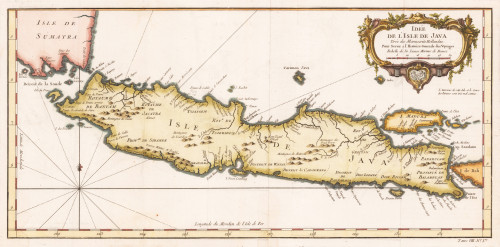
Antique Idée de L´Isle de Java Tirée des Manuscrits Hellandeis Pour Servir a l`Histoire Generale des Voyages. Idée de L´Isle de Java Tirée des Manuscrits Hellandeis Pour Servir a l`Histoire Generale des Voyages.
Bellin, Nicolaus, 1760
Original antique copper engraving, later hand colored. This beautiful map shows the islands of Java, Pulau Madura,...
€245.00
Antique A new map of Georgia with its roads & distances. Published by Thomas, Cowperthwait & Co. No. 253 Market Street Philada. A new map of Georgia with its roads & distances. Published by Thomas, Cowperthwait & Co. No. 253 Market...
Cowperthwait, Thomas & Co., 1850
Steel engraving, hand colored in outline and wash. This map of Georgia centers our attention on the roads and...
€250.00
1927 New York! 12 Original-Steinzeichnungen. [Portfolio] 1927 New York! 12 Original-Steinzeichnungen. [Portfolio]
Welti, Hanns (Robert), 1927
One of 500 machine-numbered copies (total edition 700) with 12 original lithographs produced in the Graphische...
€750.00
Antique Carte de l'Ile de Java: partie Occidentale, partie Orientale, Dressée tout nouvellement sur les Mémoirs les plus exacts; Avec une Table des principales villes de cette Ile, La situation des comptoirs & autres places qu'y possedent les Hollandois, et des Remarques très curiueuses sur la maniere dont ils se sont établis dans la Ville de Batavia. Carte de l'Ile de Java: partie Occidentale, partie Orientale, Dressée tout nouvellement sur les Mémoirs les plus...
Chatelain, Henri Abraham, 1720
A beautiful example of Henri Chatelain's important 1720 map of Java. The map was produced for Chatelain's 7...
€850.00
Antique Nova Totius Europae Tabula Nova Totius Europae Tabula
Schenk, Petrus, 1710
Original copper engraving, hand colored in outline and wash when published. Published circa 1710. Outstanding large...
€30,000.00
Antique Das Osmanische Reich in Europa mit einem Theile desselben in Asien nebst den Angränzenden oesterreichischen und russischen Gebieten in dem Stande vom Jahre 1828. Bearbeitet in VI Blättern nach den besten Quellen in der J. G. Cotta´schen geographischen Anstalt in München. Das Osmanische Reich in Europa mit einem Theile desselben in Asien nebst den Angränzenden oesterreichischen und...
Pobuda, W., 1828
Original lithographed map, uncolored. Engraved by W. Pobuda. The large map shows the region between Kolomyja in the...
€1,200.00
Antique Tabulae Geographicae. Principatus Brandbenburg: Culmb: sive Baruthini pars Inferior cum adjacentibus Regionibus exhibita et Sculpta - Matth. Seutter, S.C.M. Geogr. Aug. Vindel. Cum Gratia et Privil: Serenißimi Principis Marggravü Brandenburg Culmbacensis. Tabulae Geographicae. Principatus Brandbenburg: Culmb: sive Baruthini pars Inferior cum adjacentibus Regionibus...
Seutter, Matthäus, 1720
Original antique copper engraving, hand colored in outline and wash when published. This decorative map shows the...
€600.00
27 From 36